|
search place name
|
||
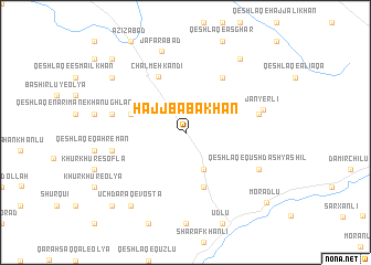
Ḩājj Bābākhān (Ostān-e Āz̄arbāyjān-e Gharbī, Iran)Ḩājj Bābākhān is a town in the Ostān-e Āz̄arbāyjān-e Gharbī region of Iran. An overview map of the region around Ḩājj Bābākhān is displayed below.
regional and 3d topo map of Ḩājj Bābākhān, Iran ::
Ḩājj Bābākhān airports ::
The nearest airport is BAK - Baku Heydar Aliyev, located 204.2 km north east of Ḩājj Bābākhān.
Other airports nearby include TBZ - Tabriz Intl (214.4 km south west), Nearby towns ::
Gūrdīgol-e Nūr ed Dīn (4.0km south) //
Yaltī Qūyūsū (5.7km south) //
Fūlād Lūqū'ī (5.7km south) //
Māyeh Darrahsī (4.7km north west) //
Chālmeh Kandī (6.0km north) //
Qeshlāq-e Ebrāhīm Khān (6.3km north east) //
Rūḩ Kandī (6.0km east) //
Khān Bābā Kandī (6.0km east) //
Petelqān (6.0km west) //
Qeshlāq-e Narīmān-e Ḩājj Havār (6.0km west) //
Jānyerlī (6.5km east) //
Qeshlāq-e Qūshdāsh Mīrzā Khān (6.8km south east) //
Qeshlāq-e Qūshdāsh Yāshīl (6.8km south east) //
Ja‘farābād (8.4km north) //
Ūch Daraq-e Vosţá (8.6km south west) //
Qeshlāq-e Ḩājj Aman (8.6km north east) //
Sorkheh Qeshlāq (8.0km north west) //
Qeshlāq-e Ḩājjī Allāhverdī (9.4km south west) //
Qeshlāq-e Soleymān Akbar (9.4km north west) //
Morādlū (9.5km south east) //
[all distances 'as the bird flies' and approximate] 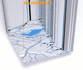 Places with similar names to Ḩājj Bābākhān, Iran :: Disclaimer :: Information on this page comes without warranty of any kind |
||
|
Where is Ḩājj Bābākhān? Elevation and coordinates ::
Latitude (lat): 39°23'0"N Longitude (lon): 48°7'0"E
Elevation (approx.): 240m (map arrows pan, magnifying glasses zoom) |
||
|
Visiting Ḩājj Bābākhān? Hotel/Accommodation ::
Book a hotel in Ḩājj Bābākhān Travel Guide ::
Buy a travel guide for Iran rental cars ::
car rental offers GPS waypoint ::
download a GPX waypoint (PoI) of Ḩājj Bābākhān for your GPS receiver
|
||