|
search place name
|
||
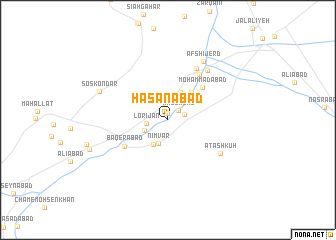
Ḩasanābād (Markaz, Iran)Ḩasanābād is a town in the Markaz region of Iran. An overview map of the region around Ḩasanābād is displayed below.
regional and 3d topo map of Ḩasanābād, Iran ::
Ḩasanābād airports ::
The nearest airport is THR - Teheran Mehrabad Intl, located 208.6 km north of Ḩasanābād.
Other airports nearby include QMJ - Masjed Soleiman Shahid Asyaee (244.3 km south west), Nearby towns ::
Seyyedābād (0.7km north) //
Majdābād (1.4km north east) //
Behjatābād (1.6km east) //
Lorījān (2.0km west) //
Cham-e Torkān (2.4km south west) //
Nīmvar (2.8km south) //
Nakhjīrvān (2.9km north) //
Amīnābād (3.1km south west) //
Shāhzādeh Zarī (3.3km north) //
Mozvar (3.8km north east) //
Moḩammadābād (4.8km north east) //
Bāqerābād (5.0km south west) //
Qal‘eh Cham (5.9km north east) //
Ḩoseynābād (6.4km north east) //
Ātash Kūh (6.2km south east) //
Āb Shegerd (6.6km north east) //
Afshījerd (7.3km north east) //
Āb Chak (7.3km north east) //
Sos Kondar (7.1km north west) //
‘Ālamābād (7.9km south west) //
[all distances 'as the bird flies' and approximate]  Places with similar names to Ḩasanābād, Iran ::
Disclaimer :: Information on this page comes without warranty of any kind |
||
|
Where is Ḩasanābād? Elevation and coordinates ::
Latitude (lat): 33°54'30"N Longitude (lon): 50°34'53"E
Elevation (approx.): 1482m (map arrows pan, magnifying glasses zoom) |
||
|
Visiting Ḩasanābād? Hotel/Accommodation ::
Book a hotel in Ḩasanābād Travel Guide ::
Buy a travel guide for Iran rental cars ::
car rental offers GPS waypoint ::
download a GPX waypoint (PoI) of Ḩasanābād for your GPS receiver
|
||