|
search place name
|
||
Ḩeşār Mehtar (Tehrān, Iran)Ḩeşār Mehtar is a town in the Tehrān region of Iran. An overview map of the region around Ḩeşār Mehtar is displayed below.
regional and 3d topo map of Ḩeşār Mehtar, Iran ::

Ḩeşār Mehtar airports ::
The nearest airport is THR - Teheran Mehrabad Intl, located 30.5 km north east of Ḩeşār Mehtar.
Other airports nearby include RZR - Ramsar (157.0 km north), RAS - Rasht (237.7 km north west), Nearby towns ::
Parandak (1.2km south east) //
Morādābād (1.2km north west) //
Peyghambar (1.6km north) //
Alārd (2.1km south east) //
Manjīlābād (2.5km north east) //
Ḩoseynābād-e Yangecheh (2.8km north) //
‘Az̧īmīyeh (2.8km north) //
‘Abdābād (2.4km south east) //
Shahrak-e Parandak (2.9km south) //
Kīkāvor (2.7km east) //
Yaqeh (3.3km north) //
Ḩājjīābād (3.5km north east) //
Shāhābād (3.6km north west) //
Anjemābād (4.1km north west) //
Zamānābād (3.8km east) //
Khalīlābād (4.6km north) //
Tangeh (4.7km south) //
Aşgharābād (4.6km south east) //
Seqer Chīn (5.1km north west) //
Shahrābād-e Īlāt (4.7km north west) //
Aşīlābād (5.4km north west) //
Farārat (5.8km north) //
Rāmīn (5.9km north) //
Ḩeşār-e Zīrak (6.3km north) //
Derāzeh (5.9km north east) //
Shahsavārī (5.9km north east) //
Zavāreh (5.3km east) //
Rang Raz (6.0km north west) //
‘Alīābād-e Derāzeh (6.3km north east) //
[all distances 'as the bird flies' and approximate] 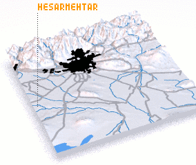 Places with similar names to Ḩeşār Mehtar, Iran ::
// Ḩeşār Mehtar (IR)
Disclaimer :: Information on this page comes without warranty of any kind |
||
|
Where is Ḩeşār Mehtar? Elevation and coordinates ::
Latitude (lat): 35°31'32"N Longitude (lon): 51°2'33"E
Elevation (approx.): 1067m (map arrows pan, magnifying glasses zoom) |
||
|
Visiting Ḩeşār Mehtar? Hotel/Accommodation ::
Book a hotel in Ḩeşār Mehtar Travel Guide ::
Buy a travel guide for Iran rental cars ::
car rental offers GPS waypoint ::
download a GPX waypoint (PoI) of Ḩeşār Mehtar for your GPS receiver
|
||