|
search place name
|
||
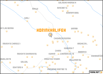
Horīn Khalīfeh (Lorestān, Iran)Horīn Khalīfeh is a town in the Lorestān region of Iran. An overview map of the region around Horīn Khalīfeh is displayed below.
regional and 3d topo map of Horīn Khalīfeh, Iran ::
Horīn Khalīfeh airports ::
The nearest airport is KSH - Bakhtaran Shahid Ashrafi Esfahani, located 92.1 km north west of Horīn Khalīfeh.
Other airports nearby include SDG - Sanandaj (191.1 km north), QMJ - Masjed Soleiman Shahid Asyaee (238.2 km south east), Nearby towns ::
Tappeh Chīā Godam (1.7km south) //
Sorkh Dom-e Lakī (2.1km south) //
‘Alīdād-e Karamī (2.5km south east) //
Dālāb-e Pāʼīn (3.2km south west) //
Chīghāzar Gerāh (3.7km south east) //
Chāh Pardan (5.2km east) //
Chīāsī (6.5km south) //
Kūh Mīr (7.2km south) //
Kūhdasht (7.5km south east) //
Dārābī (7.4km east) //
Chenār Soflá Yek (8.7km south east) //
Chenāreh (8.7km south east) //
Chenār-e ‘Olyā (8.7km south east) //
Chenār Soflá Do (8.7km south east) //
Gandābeh-ye Shīrāvand (9.3km south west) //
Bābā Qolī (9.7km south east) //
Āzād Bakht (9.8km south east) //
Sharafābād (10.0km north east) //
[all distances 'as the bird flies' and approximate]  Places with similar names to Horīn Khalīfeh, Iran :: Disclaimer :: Information on this page comes without warranty of any kind |
||
|
Where is Horīn Khalīfeh? Elevation and coordinates ::
Latitude (lat): 33°34'53"N Longitude (lon): 47°32'49"E
Elevation (approx.): 1351m (map arrows pan, magnifying glasses zoom) |
||
|
Visiting Horīn Khalīfeh? Hotel/Accommodation ::
Book a hotel in Horīn Khalīfeh Travel Guide ::
Buy a travel guide for Iran rental cars ::
car rental offers GPS waypoint ::
download a GPX waypoint (PoI) of Horīn Khalīfeh for your GPS receiver
|
||