|
search place name
|
||
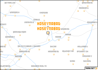
Ḩoseynābād (Iran)Ḩoseynābād is a town in Iran. An overview map of the region around Ḩoseynābād is displayed below.
regional and 3d topo map of Ḩoseynābād, Iran ::
Ḩoseynābād airports ::
The nearest airport is RZR - Ramsar, located 165.7 km north east of Ḩoseynābād.
Other airports nearby include RAS - Rasht (166.6 km north), THR - Teheran Mehrabad Intl (173.8 km east), Nearby towns ::
Ḩeşār (1.9km south) //
Ḩoseynābād (1.9km north) //
Salj (3.6km north west) //
Nohab (3.5km south east) //
Shīzar (5.8km south) //
Shabānak (5.8km north) //
Şādeqābād (4.8km east) //
Shākīn (6.0km north west) //
Sakkeznāb (6.3km south west) //
Sakīznāb (6.3km south west) //
Nahob (6.2km east) //
Ḩasanābād (7.6km south) //
Bādāmak (6.3km east) //
Khondāb (7.6km north) //
Khandāb (7.6km north) //
Varakrūd (7.1km north west) //
Qal‘eh-ye ‘Abdollāh Khān (8.2km south west) //
Ja‘farābād-e Fatḩ‘alī Khānī (8.2km south west) //
Āqjeh Qīyah (9.5km south east) //
[all distances 'as the bird flies' and approximate] 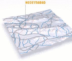 Places with similar names to Ḩoseynābād, Iran ::
Disclaimer :: Information on this page comes without warranty of any kind |
||
|
Where is Ḩoseynābād? Elevation and coordinates ::
Latitude (lat): 35°50'0"N Longitude (lon): 49°24'0"E
Elevation (approx.): 1515m (map arrows pan, magnifying glasses zoom) |
||
|
Visiting Ḩoseynābād? Hotel/Accommodation ::
Book a hotel in Ḩoseynābād Travel Guide ::
Buy a travel guide for Iran rental cars ::
car rental offers GPS waypoint ::
download a GPX waypoint (PoI) of Ḩoseynābād for your GPS receiver
|
||