|
search place name
|
||
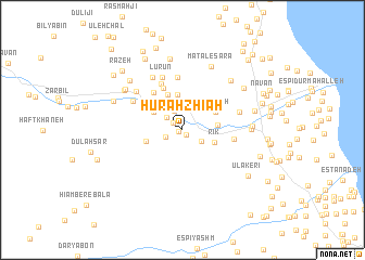
Hūrah Zhīah (Gīlān, Iran)Hūrah Zhīah is a town in the Gīlān region of Iran. An overview map of the region around Hūrah Zhīah is displayed below.
regional and 3d topo map of Hūrah Zhīah, Iran ::
Hūrah Zhīah airports ::
The nearest airport is RAS - Rasht, located 85.8 km south east of Hūrah Zhīah.
Other airports nearby include RZR - Ramsar (190.7 km south east), Nearby towns ::
Sanū (0.4km south west) //
Bāldah Karī (0.6km south east) //
Māshīn Khāneh (1.0km north west) //
Sanā Band (1.6km south west) //
Razān (1.8km north west) //
Dūleh Sar (2.0km north) //
Baskāmestūn (2.0km south east) //
Kesht Bī (2.9km north west) //
Rīk (2.9km south east) //
Hūdeh (3.6km north) //
Na‘lband (2.9km east) //
Sarāgāh (3.2km north east) //
Mas̄alankūh (3.8km north) //
Sarahlīvah (3.5km north west) //
Mīneh Bandī (3.2km west) //
Pūshak (4.6km north) //
Agrībījār (4.5km north west) //
Kīsh Dībī (5.0km north) //
Dahaneh Sīādarūn (4.3km east) //
Jengū (5.4km north) //
Tangāb-e Avval (5.0km north west) //
Lūrdan (5.7km north) //
Lūrūn (5.7km north) //
Dīzgāh (5.0km east) //
Kalehvar (5.4km north west) //
Lor (6.0km north west) //
Lamīr (6.0km north west) //
Hashtpar (5.6km east) //
Maţāle‘ Sarā (6.9km north) //
[all distances 'as the bird flies' and approximate]  Places with similar names to Hūrah Zhīah, Iran ::
// Horsehay (GB)
Disclaimer :: Information on this page comes without warranty of any kind |
||
|
Where is Hūrah Zhīah? Elevation and coordinates ::
Latitude (lat): 37°47'48"N Longitude (lon): 48°50'8"E
Elevation (approx.): 134m (map arrows pan, magnifying glasses zoom) |
||
|
Visiting Hūrah Zhīah? Hotel/Accommodation ::
Book a hotel in Hūrah Zhīah Travel Guide ::
Buy a travel guide for Iran rental cars ::
car rental offers GPS waypoint ::
download a GPX waypoint (PoI) of Hūrah Zhīah for your GPS receiver
|
||