|
search place name
|
||
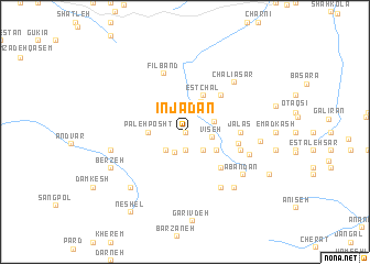
Īnjadān (Iran)Īnjadān is a town in Iran. An overview map of the region around Īnjadān is displayed below.
regional and 3d topo map of Īnjadān, Iran ::
Īnjadān airports ::
The nearest airport is THR - Teheran Mehrabad Intl, located 121.3 km west of Īnjadān.
Other airports nearby include RZR - Ramsar (192.3 km north west), Nearby towns ::
Kamar Posht (0.0km north) //
Shāldargā (1.9km south) //
Anzhdān (1.9km north) //
Katīvak (2.3km south) //
Kanafjār-e Bālā (2.4km south east) //
Katīvak-e Bālā (2.4km south west) //
Laţī (2.4km north east) //
Katb‘alī (2.4km north east) //
Tīnū (2.4km north east) //
Baneh Ben (2.4km north west) //
Vīseh (2.2km east) //
Sheykh Musá (2.8km north) //
Vandbon (2.7km north west) //
Nīnū (2.6km north east) //
Laheh (3.4km north east) //
Kaneh Fajār (3.1km south east) //
Paleh Posht (3.0km west) //
Tarjeh (3.3km north east) //
Estchāl (4.0km north) //
Bārījān (4.0km north) //
Narjeh (4.0km north) //
Līsarā (4.8km south east) //
Shālīng Chāl-e Bālā (4.8km north east) //
Kelār Zamīn (4.8km north east) //
Shālīng Chāl-e Pā'īn (4.8km north east) //
Kākarūn (4.5km east) //
Jalas (4.5km east) //
Ḩalas (4.5km east) //
Shūsh Varūn (4.9km east) //
[all distances 'as the bird flies' and approximate]  Places with similar names to Īnjadān, Iran :: Disclaimer :: Information on this page comes without warranty of any kind |
||
|
Where is Īnjadān? Elevation and coordinates ::
Latitude (lat): 36°5'0"N Longitude (lon): 52°34'0"E
Elevation (approx.): 2259m (map arrows pan, magnifying glasses zoom) |
||
|
Visiting Īnjadān? Hotel/Accommodation ::
Book a hotel in Īnjadān Travel Guide ::
Buy a travel guide for Iran rental cars ::
car rental offers GPS waypoint ::
download a GPX waypoint (PoI) of Īnjadān for your GPS receiver
|
||