|
search place name
|
||
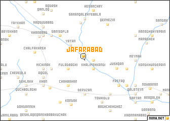
Ja‘farābād (Iran)Ja‘farābād is a town in Iran. An overview map of the region around Ja‘farābād is displayed below.
regional and 3d topo map of Ja‘farābād, Iran ::
Ja‘farābād airports ::
The nearest airport is THR - Teheran Mehrabad Intl, located 166.8 km east of Ja‘farābād.
Other airports nearby include RZR - Ramsar (215.5 km north east), Nearby towns ::
Āq Qal‘eh (1.5km east) //
Yengī Qal‘eh (1.9km north) //
Kamāl Lū (1.9km north) //
Sangestān (1.9km north) //
Khalīfeh Kandī (2.4km south east) //
Jalakbar (2.4km south east) //
Fūlād Bāghī (3.6km south west) //
Yātān (4.3km north west) //
Chāh Bahār (6.3km south west) //
Jūshqān (6.0km east) //
Derūzān (7.4km south) //
Darvāzeh (6.3km west) //
Sārī Soflá (7.2km north west) //
Khānqāh (7.2km north west) //
Sāmān Qal‘eh-ye Pā'īn (8.3km north) //
Khānābād (8.2km north west) //
Ebrāhīmābād-e Gandāb (8.7km south east) //
Fastaq (8.2km south east) //
Qermezīn (9.0km north east) //
Dakhān (8.8km south west) //
[all distances 'as the bird flies' and approximate] 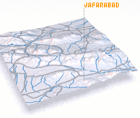 Places with similar names to Ja‘farābād, Iran ::
Disclaimer :: Information on this page comes without warranty of any kind |
||
|
Where is Ja‘farābād? Elevation and coordinates ::
Latitude (lat): 35°11'0"N Longitude (lon): 49°35'0"E
Elevation (approx.): 1785m (map arrows pan, magnifying glasses zoom) |
||
|
Visiting Ja‘farābād? Hotel/Accommodation ::
Book a hotel in Ja‘farābād Travel Guide ::
Buy a travel guide for Iran rental cars ::
car rental offers GPS waypoint ::
download a GPX waypoint (PoI) of Ja‘farābād for your GPS receiver
|
||