|
search place name
|
||
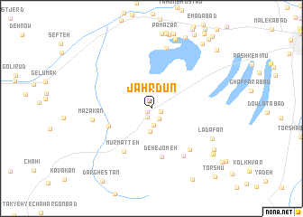
Jahrdūn (Kermān, Iran)Jahrdūn is a town in the Kermān region of Iran. An overview map of the region around Jahrdūn is displayed below.
regional and 3d topo map of Jahrdūn, Iran ::
Jahrdūn airports ::
The nearest airport is KER - Kerman, located 71.0 km north east of Jahrdūn.
Nearby towns ::
Zarafshān (0.6km south west) //
Vahābī (1.1km east) //
Gazāb-e Shekūn (1.2km south) //
Ḩājjīābād (1.5km south east) //
Kahn-e Bīd (2.1km south) //
Maqşūdak (2.9km south) //
Ḩājj Kākā (5.1km south west) //
Deh-e Jom‘eh (6.1km south) //
Mūr Matteh (6.0km south west) //
Deh-e Badrābād (6.5km south east) //
Sendūl (6.8km south east) //
Mazakān (6.5km west) //
Kebārān (7.6km north) //
Ladāfān (7.6km south east) //
Garrāhī (8.9km north) //
Arsanjān (8.4km south east) //
Bāgh-e Bazm (8.7km south east) //
Owsfūk (9.5km north) //
Darhavā (9.8km south east) //
Mo'menābād (9.6km north east) //
Moḩammadābād (10.1km north east) //
Deh-e Solţān (10.1km south east) //
Kahnūj (10.5km north east) //
Torshū (10.8km south east) //
[all distances 'as the bird flies' and approximate]  Places with similar names to Jahrdūn, Iran ::
Disclaimer :: Information on this page comes without warranty of any kind |
||
|
Where is Jahrdūn? Elevation and coordinates ::
Latitude (lat): 29°51'0"N Longitude (lon): 56°24'0"E
Elevation (approx.): 2403m (map arrows pan, magnifying glasses zoom) |
||
|
Visiting Jahrdūn? Hotel/Accommodation ::
Book a hotel in Jahrdūn Travel Guide ::
Buy a travel guide for Iran rental cars ::
car rental offers GPS waypoint ::
download a GPX waypoint (PoI) of Jahrdūn for your GPS receiver
|
||