|
search place name
|
||
Jeshār (Kermān, Iran)Jeshār is a town in the Kermān region of Iran. An overview map of the region around Jeshār is displayed below.
regional and 3d topo map of Jeshār, Iran ::

Jeshār airports ::
The nearest airport is KER - Kerman, located 198.7 km north west of Jeshār.
Other airports nearby include BND - Bandar Abbass Intl (244.9 km south west), Nearby towns ::
Jowzgarān (0.7km east) //
Daram Rūd (1.6km north east) //
Paslangar (1.6km east) //
Shīb Deh (1.6km east) //
Jowzū'īyeh (1.6km west) //
Kīūmard (2.5km north east) //
Dar Feyẕ Kūh (2.5km south east) //
Gīvmard (2.9km north west) //
Shesh Tak (6.1km south west) //
Shoghlābād (6.7km south east) //
Gerū (7.3km north east) //
Gaghār (7.6km south) //
Morīn (7.4km north west) //
Kal Sang (7.2km south west) //
Rūd Āb (7.8km south) //
Barāvarsān (7.4km south west) //
Temenū'īyeh (7.4km south west) //
Kūmī (7.6km south west) //
Korūkān (8.1km south west) //
Kal Sang (8.1km south west) //
Rūmīn (8.2km north west) //
Komīn (8.5km north west) //
Poshteh-ye Posht (9.4km south east) //
Kamar Degān-e Bālā (9.9km south west) //
Kelūpadeh (10.2km north east) //
Jam‘ (10.4km south west) //
Khoshkī Bālā (11.2km south west) //
[all distances 'as the bird flies' and approximate] 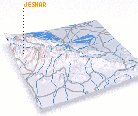 Places with similar names to Jeshār, Iran ::
Disclaimer :: Information on this page comes without warranty of any kind |
||
|
Where is Jeshār? Elevation and coordinates ::
Latitude (lat): 28°48'0"N Longitude (lon): 58°7'0"E
Elevation (approx.): 2644m (map arrows pan, magnifying glasses zoom) |
||
|
Visiting Jeshār? Hotel/Accommodation ::
Book a hotel in Jeshār Travel Guide ::
Buy a travel guide for Iran rental cars ::
car rental offers GPS waypoint ::
download a GPX waypoint (PoI) of Jeshār for your GPS receiver
|
||