|
search place name
|
||
Joghanāb-e Soflá (Iran)Joghanāb-e Soflá is a town in Iran. An overview map of the region around Joghanāb-e Soflá is displayed below.
regional and 3d topo map of Joghanāb-e Soflá, Iran ::

Joghanāb-e Soflá airports ::
The nearest airport is TBZ - Tabriz Intl, located 105.2 km south west of Joghanāb-e Soflá.
Nearby towns ::
Joghanāb-e‘Olyā (1.5km east) //
Yūzband (3.0km south) //
Tāzeh Kand-e Ţahmāseb (2.9km east) //
Parī Kandī (3.8km north) //
Kachīkāghī (3.5km east) //
Zardūghān (4.3km north) //
Kalālaq (4.6km north west) //
Armanīān (5.4km south) //
Qeshlāq-e Kolūkh (4.3km west) //
Peyghān Chāy (5.1km west) //
Bīneh (6.1km north west) //
Kalī-ye ‘Olyā (5.8km east) //
Domrīq (6.7km south west) //
Chāy Kandī (7.6km north) //
Sārī Bolāgh (7.7km south) //
Kordlar (8.1km south) //
Shekar ‘Alī Kandī (6.7km south east) //
‘Arabshāh Khān (8.3km north) //
Kalī Qūzī (7.4km north east) //
Asbeh Qalyān (8.2km south west) //
Kūrtar (8.9km south west) //
Meqyās-e Qadīm (8.9km north west) //
Gorūsheh (9.6km north east) //
Ās-e Qadīm (9.2km south east) //
[all distances 'as the bird flies' and approximate] 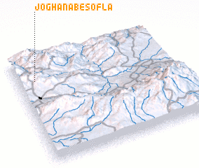 Places with similar names to Joghanāb-e Soflá, Iran :: Disclaimer :: Information on this page comes without warranty of any kind |
||
|
Where is Joghanāb-e Soflá? Elevation and coordinates ::
Latitude (lat): 38°46'47"N Longitude (lon): 47°6'59"E
Elevation (approx.): 1603m (map arrows pan, magnifying glasses zoom) |
||
|
Visiting Joghanāb-e Soflá? Hotel/Accommodation ::
Book a hotel in Joghanāb-e Soflá Travel Guide ::
Buy a travel guide for Iran rental cars ::
car rental offers GPS waypoint ::
download a GPX waypoint (PoI) of Joghanāb-e Soflá for your GPS receiver
|
||