|
search place name
|
||
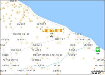
Jong Sarā (Gīlān, Iran)Jong Sarā is a town in the Gīlān region of Iran. An overview map of the region around Jong Sarā is displayed below.
regional and 3d topo map of Jong Sarā, Iran ::
Jong Sarā airports ::
The nearest airport is RZR - Ramsar, located 13.8 km east of Jong Sarā.
Other airports nearby include RAS - Rasht (92.3 km north west), THR - Teheran Mehrabad Intl (156.5 km south east), Nearby towns ::
Kabūtar Ābkesh (1.5km west) //
Mīān Deh (1.5km east) //
Dūrān (1.9km north) //
Sheykh Zāhed Maḩalleh (1.9km north) //
Korāt Maḩalleh (2.4km north west) //
Māzūkalā Poshteh (2.4km south east) //
Sarvelāt (2.8km south east) //
Jīrāvshīān (4.0km north) //
Khoshkeh Sarā (4.0km south) //
Kand Sar (3.5km north east) //
Lapā Sar (4.7km north west) //
Sefīd Tameshk (4.4km east) //
Chāleh Sarā (4.4km west) //
Chāboksar (4.8km east) //
Qāsemābād-e Pāʼīn (6.0km north west) //
Chākhānsar (5.8km north west) //
Taleh Sar (5.8km south west) //
Qāsemābād-e Soflá (6.8km north west) //
Laman Gavābor (6.2km west) //
Sūleh Sarā (7.6km south) //
Ţāleh Lam (7.6km south) //
Ardam Bon (7.1km south east) //
Ţāl Sarā (7.1km south west) //
Kashmat (7.0km south west) //
Dīsar (7.0km south east) //
Gerd Poshtehsar (8.0km south) //
Tūskā Maḩalleh (8.2km north west) //
Mīān Lāt (8.1km south east) //
Khānsar-e Qāsemābād (8.3km north west) //
[all distances 'as the bird flies' and approximate]  Places with similar names to Jong Sarā, Iran ::
// Jangasiri (NG)
Disclaimer :: Information on this page comes without warranty of any kind |
||
|
Where is Jong Sarā? Elevation and coordinates ::
Latitude (lat): 36°57'0"N Longitude (lon): 50°32'0"E
Elevation (approx.): 303m (map arrows pan, magnifying glasses zoom) |
||
|
Visiting Jong Sarā? Hotel/Accommodation ::
Book a hotel in Jong Sarā Travel Guide ::
Buy a travel guide for Iran rental cars ::
car rental offers GPS waypoint ::
download a GPX waypoint (PoI) of Jong Sarā for your GPS receiver
|
||