|
search place name
|
||
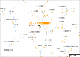
Jowkār-e Shafī‘ (Kermān, Iran)Jowkār-e Shafī‘ is a town in the Kermān region of Iran. An overview map of the region around Jowkār-e Shafī‘ is displayed below.
regional and 3d topo map of Jowkār-e Shafī‘, Iran ::
Jowkār-e Shafī‘ airports ::
The nearest airport is KER - Kerman, located 107.8 km north east of Jowkār-e Shafī‘.
Nearby towns ::
Bāgh-e Bāqerābād (0.4km north) //
Jowkār-e Bālā (2.3km east) //
Behkīn-e Bālā (3.2km south east) //
Sefteh (3.1km south east) //
Deh Marān (3.1km east) //
Ābzāgh (3.1km west) //
Ḩājj Qalandarī (3.7km south west) //
Rīgābād (3.8km south east) //
Jamālgar (4.3km north) //
Amīrābād (4.4km north) //
Cheshmeh Sabz (4.7km north east) //
Behkīn-e Pā'īn (5.0km south east) //
Andardarī (5.2km south east) //
Ablaqābād (5.1km south east) //
Deh-e Aḩmad (5.1km east) //
Esfandarān (5.9km north) //
Sefīd Ebrāhīmī (5.3km east) //
Gonbad-e Māhū'īyeh (6.1km north) //
Kahk Esfīch (6.1km south west) //
Gol-e Sorkhū (6.3km south west) //
Jafrīz (6.3km north east) //
Jūjeh Darān (6.6km north) //
Mehr Şāleḩ (6.5km south west) //
Gūgher (6.4km north east) //
Zangū'īyeh (6.8km north west) //
Gowd-e Mīānjū (7.0km north east) //
Bashbalāgh (7.3km north) //
Mūtūgīsū (7.4km north) //
Mūr-e Darān (7.5km south east) //
[all distances 'as the bird flies' and approximate]  Places with similar names to Jowkār-e Shafī‘, Iran :: Disclaimer :: Information on this page comes without warranty of any kind |
||
|
Where is Jowkār-e Shafī‘? Elevation and coordinates ::
Latitude (lat): 29°25'39"N Longitude (lon): 56°24'8"E
Elevation (approx.): 2547m (map arrows pan, magnifying glasses zoom) |
||
|
Visiting Jowkār-e Shafī‘? Hotel/Accommodation ::
Book a hotel in Jowkār-e Shafī‘ Travel Guide ::
Buy a travel guide for Iran rental cars ::
car rental offers GPS waypoint ::
download a GPX waypoint (PoI) of Jowkār-e Shafī‘ for your GPS receiver
|
||