|
search place name
|
||
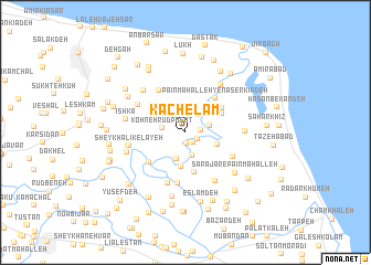
Kachelām (Gīlān, Iran)Kachelām is a town in the Gīlān region of Iran. An overview map of the region around Kachelām is displayed below.
regional and 3d topo map of Kachelām, Iran ::
Kachelām airports ::
The nearest airport is RAS - Rasht, located 46.2 km west of Kachelām.
Other airports nearby include RZR - Ramsar (66.2 km south east), THR - Teheran Mehrabad Intl (208.8 km south east), Nearby towns ::
Bālā Maḩalleh-ye Kachlām Nowsher (1.1km south) //
Nowshar (1.2km south east) //
Bālā Maḩalleh-ye Nowsher (1.2km south east) //
Kachelām-e Pā'īn Maḩalleh (1.3km east) //
Eyvān Estakhr (2.1km north east) //
Kohneh Rūdposht (1.9km west) //
Bālā Rūdposht (2.4km south) //
Mīān Maḩalleh-ye Nāşer Kīādeh (2.1km east) //
Fashū Poshteh (2.8km south) //
Sharaf Shādeh (3.1km north west) //
Chāf-e Emām Deh (3.4km south) //
Bālā Maḩalleh-ye Nāşer Kīādeh (2.9km south east) //
Bārgū Sarā (4.0km south) //
Āqā Seyyed Z̄akarīā (3.5km north east) //
Tītī Parīzād (3.8km north east) //
Pā'īn Maḩalleh-ye Nāşer Kīādeh (4.2km north east) //
Bīn Kelāyeh (4.2km south west) //
Gīldeh-e Pā'īn Maḩalleh (4.7km north west) //
Pā'īn Maḩalleh-ye Gīldeh (4.7km north west) //
Shīrjū Posht-e Bālā Maḩalleh (5.2km south) //
Kūrandeh (4.5km south east) //
Shīrjū Posht-e Pā'īn Maḩalleh (5.3km south) //
Bālā Maḩalleh-ye Gīldeh (4.7km north west) //
Kīldeh (4.7km north west) //
Şaydar Maḩalleh (5.5km south east) //
Sheykh ‘Alī Kelāyeh (4.8km west) //
Mehdīābād-e Sheykh ‘Alī Kelāyeh (4.8km west) //
Ḩasan ‘Alī Deh-e Bālā Maḩalleh (5.5km north east) //
Pā'īn Maḩalleh-ye Amīr Hendeh (5.4km north west) //
[all distances 'as the bird flies' and approximate]  Places with similar names to Kachelām, Iran ::
Disclaimer :: Information on this page comes without warranty of any kind |
||
|
Where is Kachelām? Elevation and coordinates ::
Latitude (lat): 37°18'31"N Longitude (lon): 50°7'34"E
Elevation (approx.): -22m (map arrows pan, magnifying glasses zoom) |
||
|
Visiting Kachelām? Hotel/Accommodation ::
Book a hotel in Kachelām Travel Guide ::
Buy a travel guide for Iran rental cars ::
car rental offers GPS waypoint ::
download a GPX waypoint (PoI) of Kachelām for your GPS receiver
|
||