|
search place name
|
||
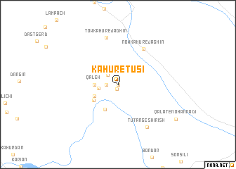
Kahūr-e Ţūsī (Kermān, Iran)Kahūr-e Ţūsī is a town in the Kermān region of Iran. An overview map of the region around Kahūr-e Ţūsī is displayed below.
regional and 3d topo map of Kahūr-e Ţūsī, Iran ::
Kahūr-e Ţūsī airports ::
The nearest airport is BND - Bandar Abbass Intl, located 99.1 km west of Kahūr-e Ţūsī.
Other airports nearby include KHS - Khasab (151.0 km south west), RKT - Ras Al Khaimah Intl (216.4 km south west), FJR - Fujeirah Fujairah Intl (242.0 km south west), SHJ - Sharjah Intl (268.3 km south west), Nearby towns ::
Darānī (0.0km north) //
Kahnān-e Sorney (0.8km south) //
Kūbā (1.7km west) //
Pā-ye Sangar (1.7km west) //
Chāh Gharbāl (2.0km north west) //
Sarney (2.8km west) //
Qal‘eh (3.3km west) //
Qalamzanī (3.8km south west) //
Rāshk-e Sarney (4.3km south west) //
Bīd Ra'īs (4.2km south west) //
Halāvān-e Sarney (4.2km south west) //
Now Kahūr-e Jaghīn (6.7km north east) //
Tow Kahūr-e Jaghīn (7.6km north) //
Tūtang-e Shīrīsh (7.9km south east) //
[all distances 'as the bird flies' and approximate] 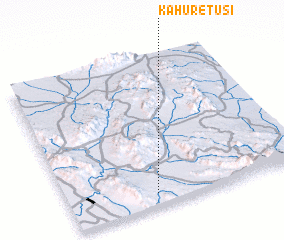 Places with similar names to Kahūr-e Ţūsī, Iran ::
Disclaimer :: Information on this page comes without warranty of any kind |
||
|
Where is Kahūr-e Ţūsī? Elevation and coordinates ::
Latitude (lat): 27°5'0"N Longitude (lon): 57°22'0"E
Elevation (approx.): 226m (map arrows pan, magnifying glasses zoom) |
||
|
Visiting Kahūr-e Ţūsī? Hotel/Accommodation ::
Book a hotel in Kahūr-e Ţūsī Travel Guide ::
Buy a travel guide for Iran rental cars ::
car rental offers GPS waypoint ::
download a GPX waypoint (PoI) of Kahūr-e Ţūsī for your GPS receiver
|
||