|
search place name
|
||
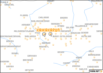
Kakārūn (Iran)Kakārūn is a town in Iran. An overview map of the region around Kakārūn is displayed below.
regional and 3d topo map of Kakārūn, Iran ::
Kakārūn airports ::
The nearest airport is THR - Teheran Mehrabad Intl, located 126.8 km west of Kakārūn.
Other airports nearby include RZR - Ramsar (198.3 km north west), Nearby towns ::
Būrūn (1.5km south east) //
Meydānak (1.6km south west) //
‘Emādkash (1.7km north east) //
Shūsh Varūn (1.9km south west) //
Kākarūn (1.9km west) //
Jalas (2.0km north west) //
Ḩalas (2.0km north west) //
‘Alātamr (3.2km south) //
Garīvash (2.9km east) //
Talleh (3.0km east) //
Nateh (3.0km east) //
Karī Yūsh (3.1km east) //
Ābandān (3.6km south west) //
Narāsam (3.9km north) //
Damīlarz (3.9km north east) //
Kolāpī (4.0km north east) //
Oţāqsī (4.0km north east) //
Golīrān (4.0km north east) //
Kaneh Fajār (3.8km west) //
Līsarā (4.2km south west) //
Vīseh (4.1km west) //
Nīnū (4.5km north west) //
Estaleh Sar (4.3km east) //
Madkheyl (5.1km south west) //
Marganeh (4.4km east) //
Bazāvsā (5.5km north east) //
Kanafjār-e Bālā (4.8km west) //
Tarjeh (5.2km north west) //
Shāshpazūn (5.0km south east) //
[all distances 'as the bird flies' and approximate] 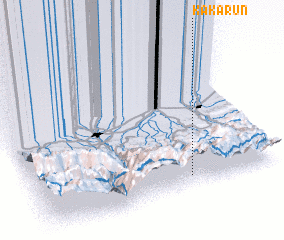 Places with similar names to Kakārūn, Iran ::
Disclaimer :: Information on this page comes without warranty of any kind |
||
|
Where is Kakārūn? Elevation and coordinates ::
Latitude (lat): 36°4'26"N Longitude (lon): 52°38'9"E
Elevation (approx.): 2775m (map arrows pan, magnifying glasses zoom) |
||
|
Visiting Kakārūn? Hotel/Accommodation ::
Book a hotel in Kakārūn Travel Guide ::
Buy a travel guide for Iran rental cars ::
car rental offers GPS waypoint ::
download a GPX waypoint (PoI) of Kakārūn for your GPS receiver
|
||