|
search place name
|
||
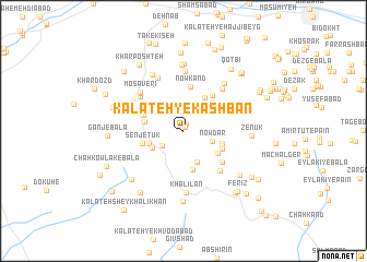
Kalāteh-ye Kashbān (Khorāsān, Iran)Kalāteh-ye Kashbān is a town in the Khorāsān region of Iran. An overview map of the region around Kalāteh-ye Kashbān is displayed below.
regional and 3d topo map of Kalāteh-ye Kashbān, Iran ::
Kalāteh-ye Kashbān airports ::
The nearest airport is XBJ - Birjand, located 21.8 km north east of Kalāteh-ye Kashbān.
Nearby towns ::
Qaşabeh (0.5km north) //
Bāgh-e Bābā Gol (0.8km north) //
Kalāteh-ye Ḩasan Beyg (2.4km south west) //
Nowdar (2.7km east) //
Chahkandūk (3.4km south) //
Kalāteh-ye Majīd (3.2km south west) //
Kalāteh-ye Kāz̧em (3.2km south west) //
Gīvak-e Pā'īn (3.8km north east) //
Ḩalvā'ī (3.4km west) //
Kalāteh-ye Karbalā'ī Barāt (4.1km south) //
Havījān (3.5km east) //
Ostād (3.8km south east) //
Zādonbeh-ye Bālā (3.7km south east) //
Hovīgān (3.7km south east) //
Zādonbeh-ye Pā'īn (3.8km south east) //
Senjetūk (3.8km west) //
Tangal-e ‘Alī Beyk (3.8km north west) //
Nowkand (4.5km north) //
Tak-e Sīfī (4.4km north east) //
Kalāteh-ye Mīr ‘Abbās (4.6km south east) //
Tījdar (5.2km south east) //
Gūbgān (5.1km north west) //
Khūnīk (4.9km north west) //
Gazak (5.4km north east) //
Ḩasanābād (5.3km north west) //
Mosāverī (5.4km north west) //
Rekāt-e Bālā (5.8km north) //
Kalāteh-ye Bālā (6.1km north) //
Khalīlān (6.3km south) //
[all distances 'as the bird flies' and approximate] 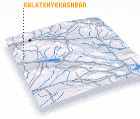 Places with similar names to Kalāteh-ye Kashbān, Iran :: Disclaimer :: Information on this page comes without warranty of any kind |
||
|
Where is Kalāteh-ye Kashbān? Elevation and coordinates ::
Latitude (lat): 32°45'42"N Longitude (lon): 59°5'53"E
Elevation (approx.): 2134m (map arrows pan, magnifying glasses zoom) |
||
|
Visiting Kalāteh-ye Kashbān? Hotel/Accommodation ::
Book a hotel in Kalāteh-ye Kashbān Travel Guide ::
Buy a travel guide for Iran rental cars ::
car rental offers GPS waypoint ::
download a GPX waypoint (PoI) of Kalāteh-ye Kashbān for your GPS receiver
|
||