|
search place name
|
||
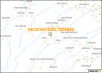
Kalāteh-ye Solţānābād (Khorāsān, Iran)Kalāteh-ye Solţānābād is a town in the Khorāsān region of Iran. An overview map of the region around Kalāteh-ye Solţānābād is displayed below.
regional and 3d topo map of Kalāteh-ye Solţānābād, Iran ::
Kalāteh-ye Solţānābād airports ::
The nearest airport is ASB - Ashkhabad Ashgabat, located 183.9 km north west of Kalāteh-ye Solţānābād.
Nearby towns ::
Kūshkān-e Bālā (2.1km north) //
Nowzād (2.3km north west) //
Esjīl (2.4km south west) //
Kūshkān-e Pā'īn (2.6km north east) //
Qal‘eh-ye Qavām Shahīdī (2.6km north east) //
Dowlatābād (3.1km south) //
Golmakān (2.8km north west) //
Kāhū (3.3km south east) //
Aḩmadābād (3.3km north east) //
Ḩoseynābād (3.9km north) //
Sang-e Sefīd (4.2km north east) //
Deh Now (5.8km north east) //
Qal‘eh Now-e Kāhū (5.5km east) //
Chenār (5.7km west) //
Gāvţernāv (7.4km north east) //
Arkī (7.1km west) //
Gorākhk (7.7km south east) //
Maʼvā (9.5km north west) //
[all distances 'as the bird flies' and approximate] 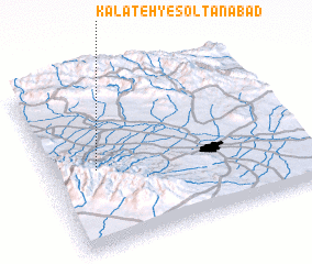 Places with similar names to Kalāteh-ye Solţānābād, Iran :: Disclaimer :: Information on this page comes without warranty of any kind |
||
|
Where is Kalāteh-ye Solţānābād? Elevation and coordinates ::
Latitude (lat): 36°27'55"N Longitude (lon): 59°10'51"E
Elevation (approx.): 1400m (map arrows pan, magnifying glasses zoom) |
||
|
Visiting Kalāteh-ye Solţānābād? Hotel/Accommodation ::
Book a hotel in Kalāteh-ye Solţānābād Travel Guide ::
Buy a travel guide for Iran rental cars ::
car rental offers GPS waypoint ::
download a GPX waypoint (PoI) of Kalāteh-ye Solţānābād for your GPS receiver
|
||