|
search place name
|
||
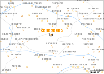
Kamarābād (Ostān-e Kermānshāh, Iran)Kamarābād is a town in the Ostān-e Kermānshāh region of Iran. An overview map of the region around Kamarābād is displayed below.
regional and 3d topo map of Kamarābād, Iran ::
Kamarābād airports ::
The nearest airport is KSH - Bakhtaran Shahid Ashrafi Esfahani, located 71.8 km south west of Kamarābād.
Other airports nearby include SDG - Sanandaj (78.9 km north west), Nearby towns ::
Kūchkīneh (3.2km south) //
Jān Aḩmad (3.5km south) //
Palangīn (3.9km north) //
Sahanleh (4.4km north west) //
Mārengāz (5.9km south) //
Ārānlah (5.9km north) //
Āb Bārīk-e ‘Olyā (5.6km north east) //
Dār Ḩeydar (6.4km north west) //
Yārehgoleh (5.9km south east) //
Āb Bārīk-e Soflá (6.6km north east) //
Sharīfābād (6.6km north east) //
‘Alīābād (6.2km north east) //
Āb Bārīk-e Vosţá (6.2km north east) //
Laylmānaj (8.3km south west) //
Bāvaleh (8.7km north) //
Qareh Tappeh (8.1km south east) //
Āq Bolāgh (9.0km south) //
‘Alī Bolāgh (8.8km north west) //
Nūrābād (9.0km north east) //
Chongoreh (10.4km north west) //
[all distances 'as the bird flies' and approximate] 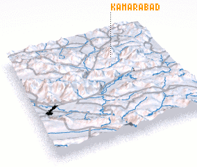 Places with similar names to Kamarābād, Iran ::
// Kumrābād (IN)
// Kum-Rabad (UZ)
// Kum-Rabad (UZ)
// Kum-Rabat (UZ)
// Cumarebito (VE)
// Cambara Boído (GW)
Disclaimer :: Information on this page comes without warranty of any kind |
||
|
Where is Kamarābād? Elevation and coordinates ::
Latitude (lat): 34°48'54"N Longitude (lon): 47°41'52"E
Elevation (approx.): 1993m (map arrows pan, magnifying glasses zoom) |
||
|
Visiting Kamarābād? Hotel/Accommodation ::
Book a hotel in Kamarābād Travel Guide ::
Buy a travel guide for Iran rental cars ::
car rental offers GPS waypoint ::
download a GPX waypoint (PoI) of Kamarābād for your GPS receiver
|
||