|
search place name
|
||
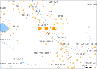
Kanaf Molk (Khūzestān, Iran)Kanaf Molk is a town in the Khūzestān region of Iran. An overview map of the region around Kanaf Molk is displayed below.
regional and 3d topo map of Kanaf Molk, Iran ::
Kanaf Molk airports ::
The nearest airport is QMJ - Masjed Soleiman Shahid Asyaee, located 80.7 km west of Kanaf Molk.
Other airports nearby include AWZ - Ahwaz (135.7 km west), MRX - Bandar Mahshahr Mahshahr (163.8 km south west), ABD - Abadan (237.5 km south west), Nearby towns ::
Barpāreh (0.6km north) //
Do Shalvārī (1.4km north east) //
Gāvzalak (1.7km south east) //
Dehzīr (2.8km north east) //
Chahār Deh (2.5km west) //
Bādāmzār (3.1km north west) //
Chahār Darreh (3.8km south) //
Adowdar (3.3km east) //
Lārm (4.3km north) //
Rāh (4.5km north east) //
Zīr Kūh-e Shālū (4.3km south east) //
Damtang (4.3km east) //
Rūzarak (5.1km north) //
Bard Zard (5.1km north east) //
Līrzard (5.2km north east) //
Āb Rāh (4.8km north east) //
Āb Sorkh (4.8km north east) //
Avend (4.8km east) //
Rak‘at-e ‘Olyā (5.2km south east) //
Pol-e Ābdū (5.6km north west) //
Bardarū (5.2km south east) //
Pātāveh (5.5km south east) //
Kahrog (6.0km north) //
Kolmot Shālū (5.9km south east) //
Pāmeleh (6.5km north) //
Cheshmeh Khātūn (6.4km north west) //
Lākam (6.6km north east) //
Rak‘at-e Soflá (6.5km south east) //
Qal‘eh Lavā (6.8km north east) //
[all distances 'as the bird flies' and approximate] 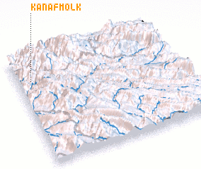 Places with similar names to Kanaf Molk, Iran :: Disclaimer :: Information on this page comes without warranty of any kind |
||
|
Where is Kanaf Molk? Elevation and coordinates ::
Latitude (lat): 31°47'40"N Longitude (lon): 50°5'18"E
Elevation (approx.): 887m (map arrows pan, magnifying glasses zoom) |
||
|
Visiting Kanaf Molk? Hotel/Accommodation ::
Book a hotel in Kanaf Molk Travel Guide ::
Buy a travel guide for Iran rental cars ::
car rental offers GPS waypoint ::
download a GPX waypoint (PoI) of Kanaf Molk for your GPS receiver
|
||