|
search place name
|
||
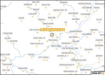
Kānī Qorbānī (Kordestān, Iran)Kānī Qorbānī is a town in the Kordestān region of Iran. An overview map of the region around Kānī Qorbānī is displayed below.
regional and 3d topo map of Kānī Qorbānī, Iran ::
Kānī Qorbānī airports ::
The nearest airport is SDG - Sanandaj, located 19.3 km north east of Kānī Qorbānī.
Other airports nearby include KSH - Bakhtaran Shahid Ashrafi Esfahani (89.6 km south), Nearby towns ::
Kānī Shalāneh (0.0km north) //
Darreh Kūleh (1.1km north) //
Savārīān (1.3km east) //
Andarāb (1.6km north) //
Hānī Vazmānī (1.4km east) //
Tārīk Now (1.9km south) //
Sarberāh (2.1km south west) //
Hānī Qorbānī (2.7km north east) //
Qolā-ye Mar (3.5km south west) //
Molām Şafā (4.0km north) //
Boz Lāneh (4.1km south) //
Darvīshān (4.3km north) //
Hādīābād (3.8km north east) //
Takyeh-ye Khāneqāh (4.2km north west) //
Khāneqāh (4.2km north west) //
Vaşī-ye ‘Olyā (4.0km west) //
Lā-ye Pol (5.2km south west) //
‘Askarān (4.9km south east) //
Galīn (4.8km north west) //
Takyeh-ye Galīn (4.9km west) //
Bezan va Bereh (4.9km east) //
Barzāb (6.2km north) //
Vaşī-ye Soflá (5.5km south west) //
Sū (6.0km north east) //
Hashlī (6.3km north west) //
Lareh Dūl (5.7km east) //
Dūl Bāgh (6.1km east) //
Kūlasah (7.6km north) //
Kūchek Chel Mah (7.1km south east) //
[all distances 'as the bird flies' and approximate]  Places with similar names to Kānī Qorbānī, Iran ::
// Koingraben (AT)
// Königgraben (AT)
Disclaimer :: Information on this page comes without warranty of any kind |
||
|
Where is Kānī Qorbānī? Elevation and coordinates ::
Latitude (lat): 35°7'0"N Longitude (lon): 46°52'0"E
Elevation (approx.): 1796m (map arrows pan, magnifying glasses zoom) |
||
|
Visiting Kānī Qorbānī? Hotel/Accommodation ::
Book a hotel in Kānī Qorbānī Travel Guide ::
Buy a travel guide for Iran rental cars ::
car rental offers GPS waypoint ::
download a GPX waypoint (PoI) of Kānī Qorbānī for your GPS receiver
|
||