|
search place name
|
||
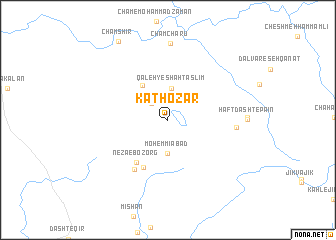
Kathozār (Fārs, Iran)Kathozār is a town in the Fārs region of Iran. An overview map of the region around Kathozār is displayed below.
regional and 3d topo map of Kathozār, Iran ::
Kathozār airports ::
The nearest airport is BUZ - Bushehr, located 127.0 km south of Kathozār.
Other airports nearby include SYZ - Shiraz Shahid Dastghaib Intl (166.6 km east), MRX - Bandar Mahshahr Mahshahr (183.8 km west), QMJ - Masjed Soleiman Shahid Asyaee (268.3 km north west), Nearby towns ::
Shāh Taslīm-e Bālā (2.5km north west) //
Qal‘eh-ye Barm-e Shūr (2.9km north) //
Qal‘eh-ye Shāh Taslīm (3.5km north) //
Mohemmīābād (3.7km south) //
Shāh Taslīm-e Pā'īn (4.5km north west) //
Nezā‘-e Bozorg (5.6km south west) //
Nezā‘-e Kūchek (5.8km south west) //
Emāmzādeh Seyyed Tājod Dīn (6.4km south west) //
Dasht-e Mīshān (6.6km east) //
Cham Charū (8.6km north) //
Haft Dasht-e Bālā (7.6km east) //
Haft Dasht-e Pā'īn (7.7km east) //
Cham Shīr (9.9km north west) //
[all distances 'as the bird flies' and approximate]  Places with similar names to Kathozār, Iran ::
// Kothi Ser (IN)
// Goth Sārh (PK)
// Goth Seri (PK)
// Goth Siri (PK)
// Goth Zar (PK)
// Goth Zaur (PK)
// Kot Hazāra (PK)
// Kot Hazāra (PK)
// Kot Hazāra (PK)
Disclaimer :: Information on this page comes without warranty of any kind |
||
|
Where is Kathozār? Elevation and coordinates ::
Latitude (lat): 30°5'0"N Longitude (lon): 50°59'0"E
Elevation (approx.): 755m (map arrows pan, magnifying glasses zoom) |
||
|
Visiting Kathozār? Hotel/Accommodation ::
Book a hotel in Kathozār Travel Guide ::
Buy a travel guide for Iran rental cars ::
car rental offers GPS waypoint ::
download a GPX waypoint (PoI) of Kathozār for your GPS receiver
|
||