|
search place name
|
||
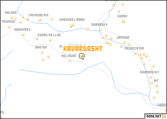
Kavār Dasht (Sīstān va Balūchestān, Iran)Kavār Dasht is a town in the Sīstān va Balūchestān region of Iran. An overview map of the region around Kavār Dasht is displayed below.
regional and 3d topo map of Kavār Dasht, Iran ::
Kavār Dasht airports ::
The nearest airport is ZBR - Chah Bahar, located 135.5 km south west of Kavār Dasht.
Other airports nearby include GWD - Gwadar (179.3 km south east), TRB - Turbo Turbat Intl (194.8 km east), Nearby towns ::
Kekdān (2.3km north west) //
Sarī Gūalm (2.3km north west) //
Kelīngān (2.8km west) //
Samūkān (4.5km north west) //
Kochok (4.5km north west) //
Kīkī (4.5km north west) //
Nabadgān (4.5km north west) //
Shūrmītag (6.0km north east) //
Dapkor (6.3km north east) //
Shār Maḩallān (6.2km north east) //
Govāsolkān (6.3km north east) //
Dāzandar (6.9km north) //
Kojūm (6.9km north) //
Tangdar (7.1km north east) //
Shāmashk (7.5km north east) //
Naşīrābād (7.2km north east) //
Pākandar (7.2km north east) //
Jagānī (7.9km north) //
Korkī (7.1km west) //
Ḩasan ‘Alīābād (8.2km north) //
Khasn-e ‘Alīābād (8.2km north) //
Esmā‘īl Kallag (8.0km north west) //
Dezbagān (8.1km east) //
Dark Pīrdān-e Bālā (11.6km north east) //
[all distances 'as the bird flies' and approximate] 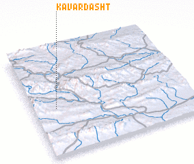 Places with similar names to Kavār Dasht, Iran :: Disclaimer :: Information on this page comes without warranty of any kind |
||
|
Where is Kavār Dasht? Elevation and coordinates ::
Latitude (lat): 26°27'0"N Longitude (lon): 61°9'0"E
Elevation (approx.): 758m (map arrows pan, magnifying glasses zoom) |
||
|
Visiting Kavār Dasht? Hotel/Accommodation ::
Book a hotel in Kavār Dasht Travel Guide ::
Buy a travel guide for Iran rental cars ::
car rental offers GPS waypoint ::
download a GPX waypoint (PoI) of Kavār Dasht for your GPS receiver
|
||