|
search place name
|
||
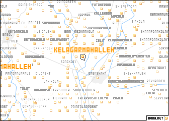
Kelāgar Maḩalleh (Iran)Kelāgar Maḩalleh is a town in Iran. An overview map of the region around Kelāgar Maḩalleh is displayed below.
regional and 3d topo map of Kelāgar Maḩalleh, Iran ::
Kelāgar Maḩalleh airports ::
The nearest airport is THR - Teheran Mehrabad Intl, located 163.8 km south west of Kelāgar Maḩalleh.
Nearby towns ::
Dīv Kolā-ye Bālā (1.2km north west) //
Dashtīān (1.9km north) //
Dīv Kalā-ye Pāʼīn (1.6km north west) //
Serāj Kolā-ye Pā'īn (2.4km south west) //
Kamchak Sarā (2.4km south east) //
Khonār (2.4km south east) //
Kervā (2.2km east) //
Gūshtī Kolā (3.7km north) //
Āb Bandān Sar (3.7km south) //
Sangtāb (3.5km north west) //
Sang Kotī (3.2km west) //
Ḩājjī Kolā (4.0km south) //
Gūshī Kolā (4.0km north) //
Bālā Rostam Ḩājjī (3.5km north west) //
Bālā Joneyd-e Lākpol (3.5km south west) //
Jīr Kolā (4.0km north) //
Sang Kotī-ye Pā'īn (3.5km south west) //
Dūk (4.0km north) //
Afrā Kotī (3.5km south west) //
Hardo Rūd (3.5km south east) //
Ojābandān (3.5km north east) //
Chamāz Katī (3.7km east) //
Naqīb Kolā-ye S̄alās (4.1km south west) //
Āsīāb Sar (3.8km west) //
Āsīāb Sar (3.8km west) //
Akhteh Chī (4.6km north west) //
Qāʼemshahr (4.5km south east) //
Kafshgar Kolā (4.8km south) //
Zelīt (4.5km north east) //
[all distances 'as the bird flies' and approximate]  Places with similar names to Kelāgar Maḩalleh, Iran ::
Disclaimer :: Information on this page comes without warranty of any kind |
||
|
Where is Kelāgar Maḩalleh? Elevation and coordinates ::
Latitude (lat): 36°30'0"N Longitude (lon): 52°50'0"E
Elevation (approx.): 24m (map arrows pan, magnifying glasses zoom) |
||
|
Visiting Kelāgar Maḩalleh? Hotel/Accommodation ::
Book a hotel in Kelāgar Maḩalleh Travel Guide ::
Buy a travel guide for Iran rental cars ::
car rental offers GPS waypoint ::
download a GPX waypoint (PoI) of Kelāgar Maḩalleh for your GPS receiver
|
||