|
search place name
|
||
Khālasht (Gīlān, Iran)Khālasht is a town in the Gīlān region of Iran. An overview map of the region around Khālasht is displayed below.
regional and 3d topo map of Khālasht, Iran ::

Khālasht airports ::
The nearest airport is RAS - Rasht, located 64.7 km east of Khālasht.
Other airports nearby include RZR - Ramsar (170.1 km east), Nearby towns ::
Khāl (0.9km south) //
Sīāhbīl (0.9km east) //
Dasht Mīān (1.1km south west) //
Kheyl Gāvān (1.5km south west) //
Jīrdey (2.1km west) //
Golī Larz (2.4km north west) //
Arkand (2.8km south west) //
Baran (2.3km west) //
Vazmī (2.7km east) //
Balangāh (2.7km east) //
Shīrbacheh Pīr (2.8km west) //
Razdārū (3.9km south west) //
Gūr (3.4km west) //
Zarāstūn (4.0km north west) //
Shīrvā (4.0km east) //
Estakhr Kenār (5.1km north) //
Rowshandeh (4.9km north west) //
Now Deh (5.8km north) //
Benāvī (5.6km north) //
Yertīm (5.5km north west) //
Malāl (5.4km south west) //
Dokān-e Shīr ‘Alī (6.1km north) //
Bolakhtār (5.0km east) //
Kohneh Keh (6.4km north) //
Vaskeh (6.4km north west) //
Bārgābzān (6.8km south) //
Bīāchāl (7.0km south) //
Chāy Khāleh (6.8km south east) //
Angūlesh (7.0km south) //
[all distances 'as the bird flies' and approximate] 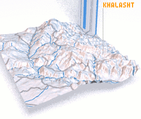 Places with similar names to Khālasht, Iran :: Disclaimer :: Information on this page comes without warranty of any kind |
||
|
Where is Khālasht? Elevation and coordinates ::
Latitude (lat): 37°28'55"N Longitude (lon): 48°54'6"E
Elevation (approx.): 1071m (map arrows pan, magnifying glasses zoom) |
||
|
Visiting Khālasht? Hotel/Accommodation ::
Book a hotel in Khālasht Travel Guide ::
Buy a travel guide for Iran rental cars ::
car rental offers GPS waypoint ::
download a GPX waypoint (PoI) of Khālasht for your GPS receiver
|
||