|
search place name
|
||
Khalīlābād (Khūzestān, Iran)Khalīlābād is a town in the Khūzestān region of Iran. An overview map of the region around Khalīlābād is displayed below.
regional and 3d topo map of Khalīlābād, Iran ::

Khalīlābād airports ::
The nearest airport is QMJ - Masjed Soleiman Shahid Asyaee, located 10.8 km south of Khalīlābād.
Other airports nearby include AWZ - Ahwaz (97.1 km south west), MRX - Bandar Mahshahr Mahshahr (171.5 km south), ABD - Abadan (215.7 km south west), BSR - Basrah Intl (230.0 km south west), Nearby towns ::
Boneh-ye Khalīl (0.0km north) //
Nūrābād (0.0km north) //
Boneh-e Allāh Yār (1.6km east) //
‘Azīzābād (1.6km west) //
Mazār Khoshk (1.6km west) //
Manşūrābād (2.9km south east) //
Ḩasanābād (3.7km south) //
Shīrīnāb (3.1km west) //
Akbarābād (3.1km west) //
Darreh Gūrū (3.1km west) //
Tang-e Moshkī (4.2km south west) //
Dasht-e Chahār Pāreh (4.9km south east) //
Amīrābād (4.9km south east) //
Kūh-e Bozberīz (5.6km south) //
Morādābād (5.7km south) //
Akbarābād (5.8km north) //
Āb Bīd Dasht (5.8km south) //
Cheshmeh-ye Shāh ‘Alī Elyās (5.1km west) //
Tang-e Mū (5.6km west) //
Ābeleh (6.0km south west) //
Par Khvājeh (6.4km north west) //
Dageh Meshgī (7.4km north) //
Bar Neshāndeh-ye Chāleh-ye Gol (7.3km south east) //
Cheshmeh Īnāq (7.3km south east) //
Nam Namī (7.3km south west) //
Seyfābād (7.7km south) //
Gohar (8.1km north east) //
Pīrbatūl (7.3km south west) //
Āb Anjīrak-e ‘Olyā (8.1km south west) //
[all distances 'as the bird flies' and approximate] 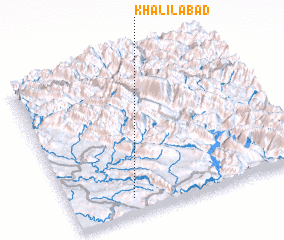 Places with similar names to Khalīlābād, Iran ::
// Khalīlābād (BD)
// Khalilābād (BD)
// Khalīlābād (IN)
// Khalīlābād (IR)
// Khalīlābād (IR)
// Khalīlābād (IR)
// Khalīlābād (IR)
// Khalīlābād (IR)
// Khalīlābād (IR)
// Khalīlābād (IR)
Disclaimer :: Information on this page comes without warranty of any kind |
||
|
Where is Khalīlābād? Elevation and coordinates ::
Latitude (lat): 32°6'0"N Longitude (lon): 49°16'0"E
Elevation (approx.): 576m (map arrows pan, magnifying glasses zoom) |
||
|
Visiting Khalīlābād? Hotel/Accommodation ::
Book a hotel in Khalīlābād Travel Guide ::
Buy a travel guide for Iran rental cars ::
car rental offers GPS waypoint ::
download a GPX waypoint (PoI) of Khalīlābād for your GPS receiver
|
||