|
search place name
|
||
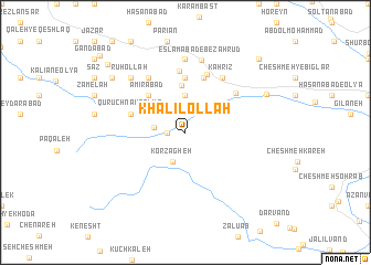
Khalīlollāh (Ostān-e Kermānshāh, Iran)Khalīlollāh is a town in the Ostān-e Kermānshāh region of Iran. An overview map of the region around Khalīlollāh is displayed below.
regional and 3d topo map of Khalīlollāh, Iran ::
Khalīlollāh airports ::
The nearest airport is KSH - Bakhtaran Shahid Ashrafi Esfahani, located 27.2 km south of Khalīlollāh.
Other airports nearby include SDG - Sanandaj (76.3 km north), Nearby towns ::
Garmāb (1.5km west) //
Garm Āb (2.7km west) //
Kor Zāgheh (3.2km south) //
Ḩojjatābād (3.7km north) //
Kortavīj-e ‘Olyā (3.8km north east) //
Molāḩāneh (4.7km north) //
Amīrābād (4.8km north west) //
Tarāzū Barreh (5.6km north) //
Sar Hafteh (5.6km north) //
Qūrūch Nak-e Soflá (4.9km west) //
Qal‘eh Bezarūd (5.8km north) //
Qūrūch Nak-e ‘Olyā (4.9km west) //
Kandūleh (6.3km north) //
Qal‘eh-ye Bozeh Rūd (6.1km north) //
‘Alīābād (5.7km north east) //
Ḩasanābād (6.3km north west) //
Kahrīz (6.3km north east) //
Cheshmeh-ye Gholām Veys (6.3km north east) //
Sharīfābād (7.4km north) //
Eslāmābād-e Bezahrūd (7.4km north) //
Rūḩollāh (7.2km north west) //
Kortavīj-e Soflá (7.7km north east) //
Godar Āb (8.3km north west) //
Fīrūzābād (9.4km north west) //
Aznāb-e ‘Olyā (9.6km north east) //
Aznāb-e Soflá (9.6km north east) //
Darāb (10.5km north west) //
[all distances 'as the bird flies' and approximate]  Places with similar names to Khalīlollāh, Iran ::
// Khalīlollāh (IR)
Disclaimer :: Information on this page comes without warranty of any kind |
||
|
Where is Khalīlollāh? Elevation and coordinates ::
Latitude (lat): 34°35'0"N Longitude (lon): 47°14'0"E
Elevation (approx.): 1655m (map arrows pan, magnifying glasses zoom) |
||
|
Visiting Khalīlollāh? Hotel/Accommodation ::
Book a hotel in Khalīlollāh Travel Guide ::
Buy a travel guide for Iran rental cars ::
car rental offers GPS waypoint ::
download a GPX waypoint (PoI) of Khalīlollāh for your GPS receiver
|
||