|
search place name
|
||
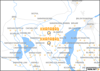
Khānābād (Khūzestān, Iran)Khānābād is a town in the Khūzestān region of Iran. An overview map of the region around Khānābād is displayed below.
regional and 3d topo map of Khānābād, Iran ::
Khānābād airports ::
The nearest airport is QMJ - Masjed Soleiman Shahid Asyaee, located 102.2 km east of Khānābād.
Other airports nearby include AWZ - Ahwaz (121.7 km south east), BSR - Basrah Intl (207.8 km south), MRX - Bandar Mahshahr Mahshahr (216.0 km south east), ABD - Abadan (219.4 km south), Nearby towns ::
Ḩājjī (0.0km north) //
Ḩājj ‘Alī Qoţb (0.0km north) //
Deh Ījī (0.0km north) //
Mīān Cheghān (0.0km north) //
Shahrak-e Emām Reẕā (0.0km north) //
Khānābād-e Qoţb (1.6km west) //
Qal‘eh-ye Ḩājjī ‘An (2.4km south east) //
Mīān Cheghān (2.4km north east) //
‘Alī Mo‘ezzī (2.7km east) //
Dezh Mūsá (3.2km south) //
Şīḩeh (3.4km north east) //
Ḩoseyn Kūchak (3.1km east) //
Khānābād (3.7km south) //
Shahrak-e Shahīd Madanī (3.1km west) //
‘Alī Ebn el Ḩoseyn (4.1km south) //
Benvār-e Ḩoseyn (4.0km north east) //
Shūhān-e ‘Olyā (3.6km south east) //
Shahrak-e Khalkhālī (3.6km south west) //
‘Alīābād (4.4km south east) //
Shahrak-e Eslāmābād (4.9km north east) //
Konjeh (4.9km north east) //
Qal‘eh-ye Showhān (4.9km south east) //
Hormozīn (4.9km south west) //
Mo‘ezzī-ye Soflá (4.9km south west) //
Shūhān-e Soflá (4.7km east) //
Pāpīābād (5.8km south) //
Shahrak-e Āzādī (5.8km north) //
Zāvīyeh Morādī (6.0km south east) //
Zāvīyeh Ḩājjīān (6.0km south east) //
[all distances 'as the bird flies' and approximate] 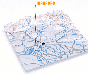 Places with similar names to Khānābād, Iran ::
Disclaimer :: Information on this page comes without warranty of any kind |
||
|
Where is Khānābād? Elevation and coordinates ::
Latitude (lat): 32°21'0"N Longitude (lon): 48°16'0"E
Elevation (approx.): 99m (map arrows pan, magnifying glasses zoom) |
||
|
Visiting Khānābād? Hotel/Accommodation ::
Book a hotel in Khānābād Travel Guide ::
Buy a travel guide for Iran rental cars ::
car rental offers GPS waypoint ::
download a GPX waypoint (PoI) of Khānābād for your GPS receiver
|
||