|
search place name
|
||
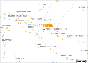
Khān-e Mehd (Iran)Khān-e Mehd is a town in Iran. An overview map of the region around Khān-e Mehd is displayed below.
regional and 3d topo map of Khān-e Mehd, Iran ::
Khān-e Mehd airports ::
The nearest airport is BND - Bandar Abbass Intl, located 132.8 km south of Khān-e Mehd.
Other airports nearby include KER - Kerman (213.2 km north), BDH - Bandar Lengeh (259.5 km south west), Nearby towns ::
Tūlūzad (1.6km east) //
Maḩmūdābād (2.5km south west) //
Ḩoseynābād (2.8km west) //
Orzū'īyeh (3.1km north west) //
'Abāsābād (3.4km south west) //
Ḩeydarābād (3.6km south west) //
‘Abbāsābād (4.0km south west) //
Tolombeh-ye Akbar Khān (3.7km north east) //
Ozū'īyeh (4.1km north) //
Qā'emābād (4.3km west) //
Shāhmārān (4.9km north west) //
Mahdābād (4.6km west) //
Tolombeh-ye Doktor -afā (4.9km east) //
Tolombeh-ye ‘Omrānī (5.2km north east) //
Tolombeh-ye Shokūhzādeh (5.2km east) //
Mehrābād (5.3km west) //
Tolombeh-ye Nīkī'ī (5.7km east) //
Sharīfābād (6.1km north west) //
Shūrak (6.8km south) //
Moḩammadābād (6.8km west) //
Farādābād (7.2km north west) //
Morādābād (7.4km north west) //
‘Alīābād-e Shamshīr Bor (7.8km south) //
Takht-e Khvājeh (7.7km south east) //
[all distances 'as the bird flies' and approximate]  Places with similar names to Khān-e Mehd, Iran ::
// Khonmīd (IR)
Disclaimer :: Information on this page comes without warranty of any kind |
||
|
Where is Khān-e Mehd? Elevation and coordinates ::
Latitude (lat): 28°25'0"N Longitude (lon): 56°23'0"E
Elevation (approx.): 1036m (map arrows pan, magnifying glasses zoom) |
||
|
Visiting Khān-e Mehd? Hotel/Accommodation ::
Book a hotel in Khān-e Mehd Travel Guide ::
Buy a travel guide for Iran rental cars ::
car rental offers GPS waypoint ::
download a GPX waypoint (PoI) of Khān-e Mehd for your GPS receiver
|
||