|
search place name
|
||
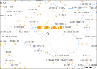
Khānqāh-e ‘Olyā (Ostān-e Kermānshāh, Iran)Khānqāh-e ‘Olyā is a town in the Ostān-e Kermānshāh region of Iran. An overview map of the region around Khānqāh-e ‘Olyā is displayed below.
regional and 3d topo map of Khānqāh-e ‘Olyā, Iran ::
Khānqāh-e ‘Olyā airports ::
The nearest airport is SDG - Sanandaj, located 51.8 km north west of Khānqāh-e ‘Olyā.
Other airports nearby include KSH - Bakhtaran Shahid Ashrafi Esfahani (52.7 km south), Nearby towns ::
Kāhelābād (1.5km west) //
Khānqāh-e Vosţá (4.4km north) //
Kīvanān (4.1km west) //
Akbarābād (4.8km north east) //
Khānqāh-e Soflá (5.6km north) //
Panbeh Dūl (4.6km east) //
Sar Barzah (6.3km south west) //
Qeshlāq (5.9km north west) //
Sīāh Darreh (6.7km south) //
Soqūlān (6.1km west) //
Kūreh (7.4km south) //
Khalīlollāh (7.4km south) //
Peshtgelān (7.4km south) //
Pīr Doāb (6.4km east) //
Sīrdūleh (6.4km east) //
Kahrīz (7.6km north) //
Sar Takht (7.1km south west) //
Sang-e Sefīd (7.1km south west) //
Melahbīd (8.0km south) //
Sīāhkhānī (8.0km south) //
Bāqerābād (8.4km north) //
Balesht (8.5km south) //
Lenjāb (8.1km north east) //
Sāmeleh (9.7km north west) //
Cheshmeh Khosrow (9.8km north west) //
[all distances 'as the bird flies' and approximate] 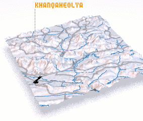 Places with similar names to Khānqāh-e ‘Olyā, Iran ::
// Khānqāh-e ‘Olyā (IR)
Disclaimer :: Information on this page comes without warranty of any kind |
||
|
Where is Khānqāh-e ‘Olyā? Elevation and coordinates ::
Latitude (lat): 34°49'0"N Longitude (lon): 47°14'0"E
Elevation (approx.): 1982m (map arrows pan, magnifying glasses zoom) |
||
|
Visiting Khānqāh-e ‘Olyā? Hotel/Accommodation ::
Book a hotel in Khānqāh-e ‘Olyā Travel Guide ::
Buy a travel guide for Iran rental cars ::
car rental offers GPS waypoint ::
download a GPX waypoint (PoI) of Khānqāh-e ‘Olyā for your GPS receiver
|
||