|
search place name
|
||
Khār Kosh (Ostān-e Kermānshāh, Iran)Khār Kosh is a town in the Ostān-e Kermānshāh region of Iran. An overview map of the region around Khār Kosh is displayed below.
regional and 3d topo map of Khār Kosh, Iran ::

Khār Kosh airports ::
The nearest airport is KSH - Bakhtaran Shahid Ashrafi Esfahani, located 66.1 km west of Khār Kosh.
Other airports nearby include SDG - Sanandaj (107.9 km north west), Nearby towns ::
‘Abd ot Tāj od Dīn (2.0km north) //
Hezār Khānī (4.0km north) //
Afshārān (3.6km south east) //
Homāyūn Kosh (3.6km south east) //
Rashtīān (4.2km north) //
Āb Bārīk (4.1km east) //
Dehnow (4.8km south west) //
Qarah Gūzlū-ye ‘Olyā (4.8km south east) //
Karīmābād (4.8km south east) //
Sarmast (5.6km south) //
Qazvīneh (5.1km south west) //
Ḩājjīābād (5.8km south) //
Ḩeşār (6.5km north) //
Jāvar Sīneh (6.3km south west) //
Tūshmālān (5.9km west) //
Hamīyānak (6.0km east) //
Dārbesar (6.1km east) //
Moḩammadābād (7.6km south) //
Qarah Gūzlū-ye Soflá (7.2km south east) //
Bardīneh (8.0km south) //
Zardeh (7.9km north east) //
‘Avīleh Gāh (8.3km south east) //
Moḩammadābād (8.3km south east) //
[all distances 'as the bird flies' and approximate] 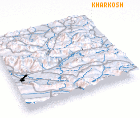 Places with similar names to Khār Kosh, Iran ::
// Khorāgāchh (BD)
// Kohorokosha (GH)
// Khargush (UZ)
// Kharah Gūsh (IR)
// Khargūshī (IR)
// Kharkesh (IR)
// Khār Kesh (IR)
// Khowrkosh (IR)
// Khowrkosh (IR)
// Khār Kachho (PK)
Disclaimer :: Information on this page comes without warranty of any kind |
||
|
Where is Khār Kosh? Elevation and coordinates ::
Latitude (lat): 34°33'0"N Longitude (lon): 47°50'0"E
Elevation (approx.): 1689m (map arrows pan, magnifying glasses zoom) |
||
|
Visiting Khār Kosh? Hotel/Accommodation ::
Book a hotel in Khār Kosh Travel Guide ::
Buy a travel guide for Iran rental cars ::
car rental offers GPS waypoint ::
download a GPX waypoint (PoI) of Khār Kosh for your GPS receiver
|
||