|
search place name
|
||
Khārzanān (Eşfahān, Iran)Khārzanān is a town in the Eşfahān region of Iran. An overview map of the region around Khārzanān is displayed below.
regional and 3d topo map of Khārzanān, Iran ::

Khārzanān airports ::
The nearest airport is AZD - Yazd Shahid Sadooghi, located 164.5 km south east of Khārzanān.
Nearby towns ::
Ābchū'īyeh (0.2km south) //
‘Eyshābād (0.3km south west) //
Bāz Boz (0.5km north) //
Pehengān (0.7km west) //
Khān Sanjed (2.0km east) //
Bāshī-e Bālā (2.4km south east) //
‘Aţrafshān (3.1km north) //
Ḩoseynābād-e Bāshī (3.0km south east) //
Koshteh (2.7km west) //
Darreh-ye Shāh Naz̧ar (2.9km west) //
Feyzābād (3.5km north) //
Qāsemābād (3.5km north) //
Chīrmān (4.1km west) //
Rasūlābād (4.6km north east) //
Moḩsenābād (5.2km north west) //
Khorramābād (4.8km east) //
Seyyedābād (5.7km north west) //
Zadūk (5.5km west) //
Cheshūtān (5.5km west) //
Moz̧affarābād (5.6km east) //
Moz̧affarābād (5.5km east) //
Ḩājjīābād (5.6km east) //
Ḩasan Beykī (6.6km south) //
Mūsáābād (5.6km east) //
Akbarābād (5.7km east) //
Jeshūqān (5.8km west) //
Kīmārān (5.9km west) //
Khorram Dasht (6.0km east) //
Jashveqān (6.1km west) //
[all distances 'as the bird flies' and approximate] 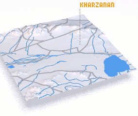 Places with similar names to Khārzanān, Iran :: Disclaimer :: Information on this page comes without warranty of any kind |
||
|
Where is Khārzanān? Elevation and coordinates ::
Latitude (lat): 32°41'10"N Longitude (lon): 52°47'30"E
Elevation (approx.): 2201m (map arrows pan, magnifying glasses zoom) |
||
|
Visiting Khārzanān? Hotel/Accommodation ::
Book a hotel in Khārzanān Travel Guide ::
Buy a travel guide for Iran rental cars ::
car rental offers GPS waypoint ::
download a GPX waypoint (PoI) of Khārzanān for your GPS receiver
|
||