|
search place name
|
||
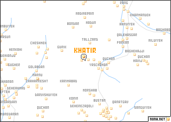
Khaţīr (Kermān, Iran)Khaţīr is a town in the Kermān region of Iran. An overview map of the region around Khaţīr is displayed below.
regional and 3d topo map of Khaţīr, Iran ::
Khaţīr airports ::
The nearest airport is KER - Kerman, located 94.5 km north of Khaţīr.
Nearby towns ::
Madīm (0.6km east) //
Deh Nowrūz (0.7km west) //
Chenār Sūkhteh (1.7km east) //
Deh Tavakkol (2.8km east) //
Yās Chaman (3.0km south east) //
Tall Zard (4.0km north) //
Deh Kahlor (3.8km south east) //
Sang Chārak (4.5km east) //
Qūchān (4.5km east) //
Gūrīk (5.0km north west) //
Karīmābād (6.2km south west) //
Kantū'īyeh (6.4km north east) //
Morghāb (7.3km south) //
Mādūn (7.6km north) //
Bondar (7.7km north) //
Sūzan (7.8km south) //
Deh-e Qareh Khān (7.4km west) //
Seyf od Dīn (7.7km west) //
Farkān (7.9km north east) //
Do Dāngī (7.8km west) //
Jūjeng (8.5km north east) //
Darvīshū'īyeh (11.2km south west) //
Chashmeh Shūr (11.4km north east) //
[all distances 'as the bird flies' and approximate]  Places with similar names to Khaţīr, Iran ::
Disclaimer :: Information on this page comes without warranty of any kind |
||
|
Where is Khaţīr? Elevation and coordinates ::
Latitude (lat): 29°28'55"N Longitude (lon): 56°35'26"E
Elevation (approx.): 2831m (map arrows pan, magnifying glasses zoom) |
||
|
Visiting Khaţīr? Hotel/Accommodation ::
Book a hotel in Khaţīr Travel Guide ::
Buy a travel guide for Iran rental cars ::
car rental offers GPS waypoint ::
download a GPX waypoint (PoI) of Khaţīr for your GPS receiver
|
||