|
search place name
|
||
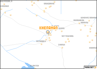
Khenāmān (Kermān, Iran)Khenāmān is a town in the Kermān region of Iran. An overview map of the region around Khenāmān is displayed below.
regional and 3d topo map of Khenāmān, Iran ::
Khenāmān airports ::
The nearest airport is KER - Kerman, located 51.2 km east of Khenāmān.
Nearby towns ::
Valīābād (0.2km south) //
Davāzdah Emām (0.7km north east) //
Qal‘eh-ye Dokhtar (0.8km east) //
Nūrābād (1.3km south) //
Kākh (1.9km north east) //
Galū Rūd (2.2km south west) //
Golūsālār (2.2km south) //
Khaleqābād-e Khenāmān (2.9km north east) //
‘Alīābād (3.3km north east) //
Reẕāābād (4.4km south west) //
Rūkerd (4.6km east) //
Ḩoseynābād-e Arjās (6.4km south east) //
Chārūk (6.8km south east) //
Seyyedābād (6.7km east) //
Arjās (7.3km east) //
Cheshmeh Bādāmū (8.4km north west) //
Zārkūh (9.0km north) //
[all distances 'as the bird flies' and approximate] 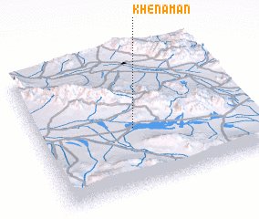 Places with similar names to Khenāmān, Iran ::
Disclaimer :: Information on this page comes without warranty of any kind |
||
|
Where is Khenāmān? Elevation and coordinates ::
Latitude (lat): 30°27'5"N Longitude (lon): 56°27'32"E
Elevation (approx.): 1973m (map arrows pan, magnifying glasses zoom) |
||
|
Visiting Khenāmān? Hotel/Accommodation ::
Book a hotel in Khenāmān Travel Guide ::
Buy a travel guide for Iran rental cars ::
car rental offers GPS waypoint ::
download a GPX waypoint (PoI) of Khenāmān for your GPS receiver
|
||