|
search place name
|
||
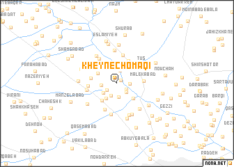
Kheyn-e Chomāqī (Khorāsān, Iran)Kheyn-e Chomāqī is a town in the Khorāsān region of Iran. An overview map of the region around Kheyn-e Chomāqī is displayed below.
regional and 3d topo map of Kheyn-e Chomāqī, Iran ::
Kheyn-e Chomāqī airports ::
The nearest airport is ASB - Ashkhabad Ashgabat, located 201.9 km north west of Kheyn-e Chomāqī.
Nearby towns ::
‘Āsheqān (0.8km north east) //
Qahqaheh (1.5km south east) //
Şeydābād (1.7km south west) //
Shabānkāreh (1.6km east) //
Tokhm Marz (1.9km south east) //
Dūstābād (2.1km south west) //
Loqmānī va Bā Sharīk (2.1km north) //
Seyyedābād (2.2km south) //
Esmā‘īlābād (2.1km west) //
Morghzār (2.3km south west) //
Amīrābād (2.7km south west) //
Sūren (3.0km north west) //
Parkandābād (3.2km south east) //
Chehel Ḩojreh (3.4km south west) //
Mesgarān (3.9km north) //
Amerqān-e Ţūs (3.7km north east) //
Nāz̧erābād (3.5km west) //
Malekābād (3.5km east) //
Kalāteh-ye Teymūrī (3.8km north east) //
Qal‘eh Now-e Bahrābād (4.5km south) //
Bāgh-e Shalvārān (4.6km north) //
Amīnābād (3.7km west) //
Mordār Keshān (4.6km north west) //
Ţūs (4.4km north east) //
Zarkesh (4.1km west) //
Kalāteh-ye Mashhad Qolī (5.1km south) //
Esfandīān (5.4km north) //
Sar Bāghān (5.1km north west) //
Kūshk-e Mehdī (5.3km south) //
[all distances 'as the bird flies' and approximate] 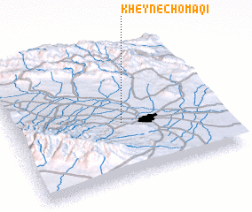 Places with similar names to Kheyn-e Chomāqī, Iran :: Disclaimer :: Information on this page comes without warranty of any kind |
||
|
Where is Kheyn-e Chomāqī? Elevation and coordinates ::
Latitude (lat): 36°25'38"N Longitude (lon): 59°31'52"E
Elevation (approx.): 986m (map arrows pan, magnifying glasses zoom) |
||
|
Visiting Kheyn-e Chomāqī? Hotel/Accommodation ::
Book a hotel in Kheyn-e Chomāqī Travel Guide ::
Buy a travel guide for Iran rental cars ::
car rental offers GPS waypoint ::
download a GPX waypoint (PoI) of Kheyn-e Chomāqī for your GPS receiver
|
||