|
search place name
|
||
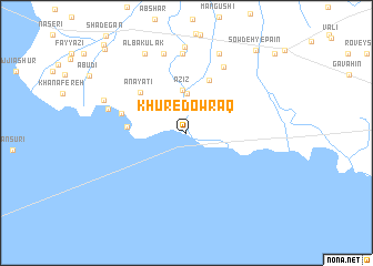
Khūr-e Dowraq (Khūzestān, Iran)Khūr-e Dowraq is a town in the Khūzestān region of Iran. An overview map of the region around Khūr-e Dowraq is displayed below.
regional and 3d topo map of Khūr-e Dowraq, Iran ::
Khūr-e Dowraq airports ::
The nearest airport is MRX - Bandar Mahshahr Mahshahr, located 39.8 km east of Khūr-e Dowraq.
Other airports nearby include ABD - Abadan (53.2 km south west), AWZ - Ahwaz (86.1 km north), BSR - Basrah Intl (103.2 km west), KWI - Kuwait Intl (165.5 km south west), Nearby towns ::
Sheykh Badīr (2.7km north east) //
Khūr (2.7km north east) //
Beyt-e Ḩājjī Moslem (4.0km north) //
‘Azīz (4.3km north) //
Nahr-e Gabīn (4.3km north west) //
Maḩrūqī (5.7km north) //
Nahr-e Moz̄ayyef (5.2km west) //
‘Anāyatī (5.7km north west) //
‘Anāyatī-ye Pāʼīn (5.9km west) //
Jadīd (7.4km north east) //
Ḩadbeh (8.0km north) //
Nahr-e Ḩoseyn (7.2km west) //
Ābshār (8.2km north) //
Nahr-e Mosallam (8.6km north) //
Nahr-e Dalī (8.5km north) //
Mosayyer (7.9km north west) //
Al Bakūlak (8.8km north west) //
Sowdeh-ye Pāʼīn (10.3km north east) //
Sa‘dī (11.0km north west) //
Garyāvī (11.0km north east) //
[all distances 'as the bird flies' and approximate]  Places with similar names to Khūr-e Dowraq, Iran :: Disclaimer :: Information on this page comes without warranty of any kind |
||
|
Where is Khūr-e Dowraq? Elevation and coordinates ::
Latitude (lat): 30°33'41"N Longitude (lon): 48°44'14"E
Elevation (approx.): 6m (map arrows pan, magnifying glasses zoom) |
||
|
Visiting Khūr-e Dowraq? Hotel/Accommodation ::
Book a hotel in Khūr-e Dowraq Travel Guide ::
Buy a travel guide for Iran rental cars ::
car rental offers GPS waypoint ::
download a GPX waypoint (PoI) of Khūr-e Dowraq for your GPS receiver
|
||