|
search place name
|
||
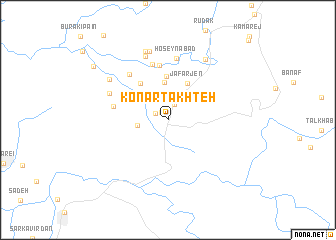
Konār Takhteh (Fārs, Iran)Konār Takhteh is a town in the Fārs region of Iran. An overview map of the region around Konār Takhteh is displayed below.
regional and 3d topo map of Konār Takhteh, Iran ::
Konār Takhteh airports ::
The nearest airport is BUZ - Bushehr, located 84.5 km south west of Konār Takhteh.
Other airports nearby include SYZ - Shiraz Shahid Dastghaib Intl (115.7 km east), Nearby towns ::
Bonakī (1.1km north west) //
Torkābād (1.4km north west) //
Kamān Keshī (1.9km north) //
Gūrīgāh (2.3km north west) //
Būrakī Bālā (3.0km west) //
Boneh-ye Seyyed Moḩammad Reẕā (4.2km north) //
Ja‘far Jen (4.5km north east) //
Moghīs̄ābād (4.9km north) //
Maḩl od Dīn (4.9km north west) //
Māfīābād (5.1km north west) //
Nez̧āmābād (6.1km north) //
Emāmzādeh ‘Alī (5.5km west) //
Ne‘matābād (6.4km north) //
Chahār Borj (6.3km north west) //
Ḩoseynābād (6.9km north) //
Shāh Dāvūd (6.4km north west) //
Ījānī (7.4km north) //
Cherūm (7.6km north east) //
Borj-e Seyyed (7.8km north) //
Khesht (7.2km north west) //
Choghāsā'ī (8.0km north) //
Bezīn (9.3km north west) //
[all distances 'as the bird flies' and approximate] 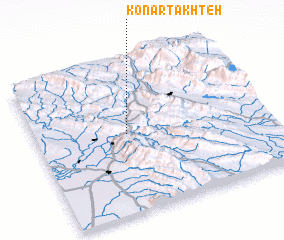 Places with similar names to Konār Takhteh, Iran :: Disclaimer :: Information on this page comes without warranty of any kind |
||
|
Where is Konār Takhteh? Elevation and coordinates ::
Latitude (lat): 29°31'37"N Longitude (lon): 51°23'46"E
Elevation (approx.): 507m (map arrows pan, magnifying glasses zoom) |
||
|
Visiting Konār Takhteh? Hotel/Accommodation ::
Book a hotel in Konār Takhteh Travel Guide ::
Buy a travel guide for Iran rental cars ::
car rental offers GPS waypoint ::
download a GPX waypoint (PoI) of Konār Takhteh for your GPS receiver
|
||