|
search place name
|
||
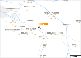
Kondo Rūd (Ostān-e Āz̄arbāyjān-e Sharqī, Iran)Kondo Rūd is a town in the Ostān-e Āz̄arbāyjān-e Sharqī region of Iran. An overview map of the region around Kondo Rūd is displayed below.
regional and 3d topo map of Kondo Rūd, Iran ::
Kondo Rūd airports ::
The nearest airport is TBZ - Tabriz Intl, located 25.1 km north west of Kondo Rūd.
Nearby towns ::
Ne‘matābād (1.1km north west) //
Bāsmenj (3.2km south east) //
Jānqūr (3.3km south west) //
Bāgh-e Ya‘qūb (3.5km west) //
Ḩājj ‘Abdāl (4.6km south) //
Dīzaj-eLeylīkhān (5.2km south east) //
Bāsmenj (4.7km south east) //
Kargaj (4.8km north west) //
Shādābād-e ‘Olyā (5.6km south west) //
Gazānband (6.1km north east) //
Tūyqūn (7.0km north) //
Qezelejeh-ye Meydān (6.0km south east) //
Kavār (7.6km north east) //
Bāvīqūn (7.1km north east) //
Hervī (8.5km south) //
Fatḩābād (6.9km west) //
Malek Kīān (8.5km north east) //
Ārpā Darrahsī (9.7km north west) //
[all distances 'as the bird flies' and approximate] 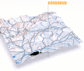 Places with similar names to Kondo Rūd, Iran ::
Disclaimer :: Information on this page comes without warranty of any kind |
||
|
Where is Kondo Rūd? Elevation and coordinates ::
Latitude (lat): 38°0'27"N Longitude (lon): 46°28'20"E
Elevation (approx.): 1697m (map arrows pan, magnifying glasses zoom) |
||
|
Visiting Kondo Rūd? Hotel/Accommodation ::
Book a hotel in Kondo Rūd Travel Guide ::
Buy a travel guide for Iran rental cars ::
car rental offers GPS waypoint ::
download a GPX waypoint (PoI) of Kondo Rūd for your GPS receiver
|
||