|
search place name
|
||
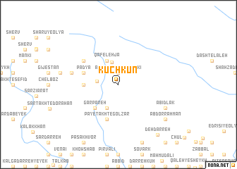
Kūchkūn (Khūzestān, Iran)Kūchkūn is a town in the Khūzestān region of Iran. An overview map of the region around Kūchkūn is displayed below.
regional and 3d topo map of Kūchkūn, Iran ::
Kūchkūn airports ::
The nearest airport is QMJ - Masjed Soleiman Shahid Asyaee, located 128.9 km south east of Kūchkūn.
Other airports nearby include AWZ - Ahwaz (176.6 km south), KSH - Bakhtaran Shahid Ashrafi Esfahani (197.5 km north west), Nearby towns ::
Āb Zahleh-ye Anārakī (1.9km north) //
Boneh-ye Āqā Bozorg (2.9km west) //
Mīrā Alī (3.6km north) //
Bārīkāb (4.0km south west) //
Qāfeleh Jā (4.0km north west) //
Garpāreh (4.8km south west) //
Boneh-ye Ḩājjī ‘Alī (4.7km west) //
Padyā (5.0km west) //
Boneh-ye Dūst Moḩammad (5.0km west) //
Pā-ye Takht-e Golzār (5.8km south) //
Sar Seyl-e Zardābeh-ye Moḩammad Ţāher (5.8km south) //
Ḩājjī ‘Alī Hīkī (5.0km west) //
Boneh-ye Moḩammad (6.0km north west) //
Darreh-ye Dūraq (6.5km west) //
Ābīdlāk (7.2km south east) //
‘Abd or Raḩmān (8.3km south east) //
Nīm Mardī (8.3km south east) //
Deh Darreh (9.5km south east) //
[all distances 'as the bird flies' and approximate] 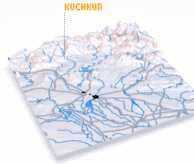 Places with similar names to Kūchkūn, Iran ::
Disclaimer :: Information on this page comes without warranty of any kind |
||
|
Where is Kūchkūn? Elevation and coordinates ::
Latitude (lat): 32°54'0"N Longitude (lon): 48°24'0"E
Elevation (approx.): 1032m (map arrows pan, magnifying glasses zoom) |
||
|
Visiting Kūchkūn? Hotel/Accommodation ::
Book a hotel in Kūchkūn Travel Guide ::
Buy a travel guide for Iran rental cars ::
car rental offers GPS waypoint ::
download a GPX waypoint (PoI) of Kūchkūn for your GPS receiver
|
||