|
search place name
|
||
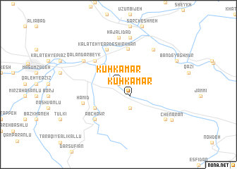
Kūh Kamar (Khorāsān, Iran)Kūh Kamar is a town in the Khorāsān region of Iran. An overview map of the region around Kūh Kamar is displayed below.
regional and 3d topo map of Kūh Kamar, Iran ::
Kūh Kamar airports ::
The nearest airport is ASB - Ashkhabad Ashgabat, located 100.0 km north east of Kūh Kamar.
Nearby towns ::
Chahār Kharvār (0.0km north) //
Kūhkamar (2.4km south east) //
Pīqū (4.0km south) //
Kalāteh-ye Āshīān (4.7km north west) //
Bābā Amān (4.7km north west) //
Qal‘eh-ye Ḩamīd (4.7km south west) //
Qārleq (5.7km north) //
Kalāteh-ye Ardeshīrkhān (5.8km north) //
Ḩamīd (5.4km south west) //
Qalandar Beyk (5.8km north west) //
Ābchowr (6.3km south west) //
Ḩeşār-e Garmkhān (7.4km north) //
Kalāteh-ye Chalū (7.4km north) //
Ḩāj ‘Alīdād (7.4km north) //
Kalāteh-ye Fīrūzeh Khān (7.4km north) //
Kalāteh-ye Ḩājj Shahsavār (7.6km north) //
Qarah Khān Bandī (7.1km north east) //
Ţarāqī Tork (8.1km south east) //
Chenārān (8.8km south east) //
[all distances 'as the bird flies' and approximate] 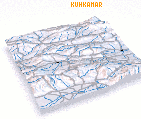 Places with similar names to Kūh Kamar, Iran ::
Disclaimer :: Information on this page comes without warranty of any kind |
||
|
Where is Kūh Kamar? Elevation and coordinates ::
Latitude (lat): 37°27'0"N Longitude (lon): 57°27'0"E
Elevation (approx.): 1056m (map arrows pan, magnifying glasses zoom) |
||
|
Visiting Kūh Kamar? Hotel/Accommodation ::
Book a hotel in Kūh Kamar Travel Guide ::
Buy a travel guide for Iran rental cars ::
car rental offers GPS waypoint ::
download a GPX waypoint (PoI) of Kūh Kamar for your GPS receiver
|
||