|
search place name
|
||
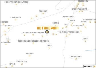
Kūtak-e Pā'īn (Kermān, Iran)Kūtak-e Pā'īn is a town in the Kermān region of Iran. An overview map of the region around Kūtak-e Pā'īn is displayed below.
regional and 3d topo map of Kūtak-e Pā'īn, Iran ::
Kūtak-e Pā'īn airports ::
The nearest airport is BND - Bandar Abbass Intl, located 141.1 km south west of Kūtak-e Pā'īn.
Other airports nearby include KHS - Khasab (232.1 km south west), Nearby towns ::
Rashkord (1.7km east) //
Kutak-e Bālā (2.1km south west) //
Sarlāvar (2.8km east) //
Sar Rīg (4.3km north east) //
Gerū (5.5km south) //
Tolombeh-ye Chāh Ghāfel (5.2km west) //
Nūrābād (5.6km north east) //
Tolombeh-ye Morād-e Golmoḩammad (6.2km south west) //
Lambūrū (6.4km east) //
Zeh (6.8km north east) //
Tolombeh-ye Reẕāābād (7.1km east) //
Bon Gowd (8.2km north) //
Chāh Rīgān-e Bālā (8.2km north west) //
Chāh Rīgān-e Pā'īn (8.4km north west) //
Ḩeydarābād (9.3km north east) //
Gardīārī (10.6km south west) //
[all distances 'as the bird flies' and approximate] 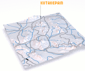 Places with similar names to Kūtak-e Pā'īn, Iran ::
Disclaimer :: Information on this page comes without warranty of any kind |
||
|
Where is Kūtak-e Pā'īn? Elevation and coordinates ::
Latitude (lat): 27°52'27"N Longitude (lon): 57°36'7"E
Elevation (approx.): 541m (map arrows pan, magnifying glasses zoom) |
||
|
Visiting Kūtak-e Pā'īn? Hotel/Accommodation ::
Book a hotel in Kūtak-e Pā'īn Travel Guide ::
Buy a travel guide for Iran rental cars ::
car rental offers GPS waypoint ::
download a GPX waypoint (PoI) of Kūtak-e Pā'īn for your GPS receiver
|
||