|
search place name
|
||
Kūt-e Sa‘īd (Khūzestān, Iran)Kūt-e Sa‘īd is a town in the Khūzestān region of Iran. An overview map of the region around Kūt-e Sa‘īd is displayed below.
regional and 3d topo map of Kūt-e Sa‘īd, Iran ::

Kūt-e Sa‘īd airports ::
The nearest airport is ABD - Abadan, located 3.6 km north east of Kūt-e Sa‘īd.
Other airports nearby include BSR - Basrah Intl (56.2 km north west), MRX - Bandar Mahshahr Mahshahr (94.2 km east), AWZ - Ahwaz (122.0 km north east), KWI - Kuwait Intl (126.5 km south), Nearby towns ::
Omm ol Qaşab-e Ḩāj ‘Alī (0.0km north) //
Banak (0.0km north) //
Omm ol Kharnūb (0.0km north) //
Na‘īmīyeh-ye Seyyed Nāşer (0.0km north) //
Na‘īmīyeh-ye Moḩammad Aḩsan (0.0km north) //
Maqāţī‘ (0.0km north) //
Omm ol Hasifeh (0.4km west) //
‘Abd ol Emām-e Feyşal (0.6km south) //
Bahiyeh-ye Najm Dīvāo (0.9km south) //
Omm Ayāy (1.0km north) //
Sanad Rāshed (1.1km north west) //
Şomeydīyeh (1.2km east) //
Zair ‘Abdollāh (1.4km north east) //
Shalheh-ye Majīd (1.5km north) //
Reẕāgāh (1.6km south) //
Mo ‘ammareh Ghisheh (1.5km east) //
Chūmeh (1.6km east) //
Omm ol Khoşofeh-ye ‘Ammāreh (1.6km east) //
Omm ol ‘Ejāj (1.6km east) //
Khoreybeh-ye Mahyūb (1.6km east) //
Mazra‘eh (1.9km north) //
‘Abd ol Emām (1.9km north) //
Nahr-e Sādāt (1.9km north) //
Nahr-e Mājedī (1.9km north) //
Omm ol Qaşab-e Moshtāq (1.9km south) //
Baḩrīyeh-ye Şādeq (1.9km south) //
Baḩrīyeh-ye Shomāī (1.9km south) //
Sayḩān (1.8km south west) //
Raddeh-ye Alvānīyeh (1.8km east) //
[all distances 'as the bird flies' and approximate] 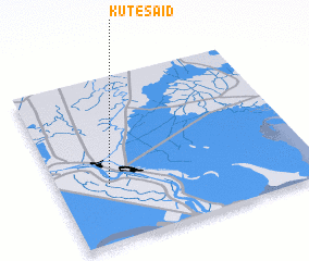 Places with similar names to Kūt-e Sa‘īd, Iran ::
// Gate City (US)
// Catecito (PA)
// Catecito (PA)
// Catecito (PA)
// Codisotto (IT)
// Kūt as Sayyid (IQ)
// Codeceda (PT)
// Godziętowy (PL)
// Kidaste (EE)
// Kodeste (EE)
Disclaimer :: Information on this page comes without warranty of any kind |
||
|
Where is Kūt-e Sa‘īd? Elevation and coordinates ::
Latitude (lat): 30°21'0"N Longitude (lon): 48°12'0"E
Elevation (approx.): 2m (map arrows pan, magnifying glasses zoom) |
||
|
Visiting Kūt-e Sa‘īd? Hotel/Accommodation ::
Book a hotel in Kūt-e Sa‘īd Travel Guide ::
Buy a travel guide for Iran rental cars ::
car rental offers GPS waypoint ::
download a GPX waypoint (PoI) of Kūt-e Sa‘īd for your GPS receiver
|
||