|
search place name
|
||
Kūt-e Seyyed ‘Enāyah (Khūzestān, Iran)Kūt-e Seyyed ‘Enāyah is a town in the Khūzestān region of Iran. An overview map of the region around Kūt-e Seyyed ‘Enāyah is displayed below.
regional and 3d topo map of Kūt-e Seyyed ‘Enāyah, Iran ::

Kūt-e Seyyed ‘Enāyah airports ::
The nearest airport is AWZ - Ahwaz, located 13.8 km south of Kūt-e Seyyed ‘Enāyah.
Other airports nearby include QMJ - Masjed Soleiman Shahid Asyaee (74.8 km north east), MRX - Bandar Mahshahr Mahshahr (104.8 km south), ABD - Abadan (132.4 km south west), BSR - Basrah Intl (148.7 km south west), Nearby towns ::
Kūt-e Seyyed Solţān (0.3km south east) //
Seyyed Tamūl (0.8km south east) //
Seyyed Sharīf (1.2km north east) //
Beyt ‘Abd ‘Al (3.3km north) //
Haiyareh (3.3km north) //
Gobeyr-e Do (3.4km north west) //
Seyyedīyeh (4.2km north) //
Seyyed ‘Enāyat (4.3km south) //
Kūt-e Seyyed ‘Enāyat (4.2km south west) //
Sho‘aymaţ-e Do (4.2km north west) //
Sho‘aymaţ-e Yek (4.4km north west) //
Sho‘aymaţ-e Yek (4.4km north west) //
Sho‘aymaţ-e Yek (4.4km north west) //
Seyyed Rāzī (4.9km south west) //
Qal‘eh-ye AbūQāl (4.9km north west) //
Gobeyr-e Yek (4.5km west) //
Abū Boqqāl (5.4km north west) //
Abū Fāẕel-e Zargān (5.0km south east) //
Gobeyr-e Seh (5.3km west) //
Qal‘eh-ye Ā1/4arī (5.7km south east) //
Shobeysheh (5.9km south west) //
Amīleh (5.5km east) //
Moveyleḩeh (6.0km north east) //
Beyt-e Malūḩ (6.4km south east) //
Malīḩeh (6.2km east) //
Manşūrīyeh-ye Yek (6.5km north east) //
Beyt-e Maḩāreb (7.4km south east) //
‘Ayyāshīyeh (7.9km south) //
Jassānīyeh-ye Bozorg (7.1km south west) //
[all distances 'as the bird flies' and approximate] 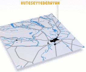 Places with similar names to Kūt-e Seyyed ‘Enāyah, Iran ::
Disclaimer :: Information on this page comes without warranty of any kind |
||
|
Where is Kūt-e Seyyed ‘Enāyah? Elevation and coordinates ::
Latitude (lat): 31°27'16"N Longitude (lon): 48°48'37"E
Elevation (approx.): 23m (map arrows pan, magnifying glasses zoom) |
||
|
Visiting Kūt-e Seyyed ‘Enāyah? Hotel/Accommodation ::
Book a hotel in Kūt-e Seyyed ‘Enāyah Travel Guide ::
Buy a travel guide for Iran rental cars ::
car rental offers GPS waypoint ::
download a GPX waypoint (PoI) of Kūt-e Seyyed ‘Enāyah for your GPS receiver
|
||