|
search place name
|
||
Kūzan (Golestān, Iran)Kūzan is a town in the Golestān region of Iran. An overview map of the region around Kūzan is displayed below.
regional and 3d topo map of Kūzan, Iran ::

Nearby towns ::
‘Aţāābād (0.8km north west) //
Anbār Tappeh (1.4km south) //
Jahānābād-e Pā'īn (2.5km south west) //
Mīr Maḩalleh (3.5km south west) //
Jahānābād-e Bālā (3.7km south west) //
Ūneq Yelqī-ye Pā'īn (3.3km west) //
Pīrāvash-e Jorjānīyeh (3.5km south east) //
Ūneq Yelqī-ye Bālā (3.4km west) //
Chenār Qeshlāq (4.1km south east) //
Sheykh Tappeh (3.7km west) //
Būrbūr Tappeh (3.8km west) //
Now Deh (3.8km west) //
Peyrovān (4.0km east) //
Qezlī (4.9km north) //
Gūzan-e Fārs (5.0km south) //
Shaftālū Bāgh-e Pā'īn (4.9km north east) //
Kordābād (5.2km north east) //
Kūrān Tappeh (5.3km south west) //
Ma‘şūmābād (5.3km south west) //
Bolbol Tappeh (5.1km west) //
‘Os̄mānābād (5.1km west) //
Pīrāvash-e Ḩājjī Ḩabīb (5.3km east) //
Neshī (5.8km north east) //
Shaftālū Bāgh-e Bālā (5.6km north east) //
Emāmzādeh ‘Azīz (6.8km south) //
Tūrang Tappeh (6.3km south west) //
Pīr Āghāj (5.8km south west) //
Ḩoseynābād-e Malek (6.9km south) //
Qareh Tappeh (7.2km north) //
[all distances 'as the bird flies' and approximate] 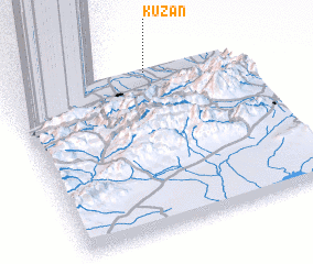 Places with similar names to Kūzan, Iran ::
Disclaimer :: Information on this page comes without warranty of any kind |
||
|
Where is Kūzan? Elevation and coordinates ::
Latitude (lat): 36°58'40"N Longitude (lon): 54°37'26"E
Elevation (approx.): 11m (map arrows pan, magnifying glasses zoom) |
||
|
Visiting Kūzan? Hotel/Accommodation ::
Book a hotel in Kūzan Travel Guide ::
Buy a travel guide for Iran rental cars ::
car rental offers GPS waypoint ::
download a GPX waypoint (PoI) of Kūzan for your GPS receiver
|
||