|
search place name
|
||
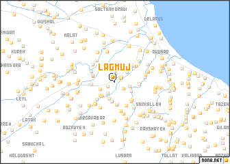
Lagmūj (Gīlān, Iran)Lagmūj is a town in the Gīlān region of Iran. An overview map of the region around Lagmūj is displayed below.
regional and 3d topo map of Lagmūj, Iran ::
Lagmūj airports ::
The nearest airport is RZR - Ramsar, located 46.2 km south east of Lagmūj.
Other airports nearby include RAS - Rasht (59.8 km north west), THR - Teheran Mehrabad Intl (184.9 km south east), Nearby towns ::
Shekarpas (1.0km north east) //
Kohneh Gorāb (1.2km north east) //
Kīā Kolāyeh (1.2km south west) //
Ostād Kolāyeh (1.6km north) //
Kūyeh-ye ‘Olyā (1.5km south east) //
Tāzehābād-e Narakeh (2.1km south west) //
Narakeh (2.1km south west) //
Lalīk Sarā (2.0km east) //
Karaf Maḩalleh (2.2km north east) //
Zarbījār (2.2km south west) //
Mīān Maḩalleh-ye Sūr (2.9km north) //
Ābdangsar-e Lātleyl (2.8km south) //
Sefīddārbon (2.6km south east) //
Pīleh Bāgh (2.8km north east) //
Sūrkūh (3.0km north west) //
Nārenj Dārbon (2.9km south west) //
Chālākash (2.9km south west) //
Kash Kalāyeh (3.2km south) //
Pīsh Bījār (2.9km north east) //
Mashgaleh (3.0km north west) //
Khomeynī Sarā (3.2km north east) //
Shāh Sarā (3.2km north east) //
‘Alīābād-e Rameshāyeh (3.7km south) //
Tāzehābād-e Āsīāb Sarā (3.7km south) //
Kīā Kahān (3.0km west) //
Solūsh (3.1km west) //
Amlash (3.1km west) //
Kūyeh-ye Soflá (3.2km east) //
Ashkar Meydān (3.2km east) //
[all distances 'as the bird flies' and approximate]  Places with similar names to Lagmūj, Iran ::
// Logo Moji (GM)
Disclaimer :: Information on this page comes without warranty of any kind |
||
|
Where is Lagmūj? Elevation and coordinates ::
Latitude (lat): 37°6'4"N Longitude (lon): 50°13'6"E
Elevation (approx.): 2m (map arrows pan, magnifying glasses zoom) |
||
|
Visiting Lagmūj? Hotel/Accommodation ::
Book a hotel in Lagmūj Travel Guide ::
Buy a travel guide for Iran rental cars ::
car rental offers GPS waypoint ::
download a GPX waypoint (PoI) of Lagmūj for your GPS receiver
|
||