|
search place name
|
||
Lankeh Daraq (Iran)Lankeh Daraq is a town in Iran. An overview map of the region around Lankeh Daraq is displayed below.
regional and 3d topo map of Lankeh Daraq, Iran ::

Lankeh Daraq airports ::
The nearest airport is TBZ - Tabriz Intl, located 180.6 km south west of Lankeh Daraq.
Other airports nearby include RAS - Rasht (223.2 km south east), BAK - Baku Heydar Aliyev (242.8 km north east), Nearby towns ::
Tūlūn (0.2km south) //
Sheykh Chakhmāq Dāgh (2.1km north east) //
Ānī Kandī (2.3km north west) //
‘Azīzlū (2.3km north east) //
Soleymālū (4.0km north) //
Deman (4.4km south) //
Olī Kandī (4.7km north west) //
Avaş (4.5km east) //
Mashhadlū (5.7km north) //
Moghvān (5.9km north) //
Choqūngonash (5.7km west) //
Lalah Bolāghī (7.6km north) //
Qeshlāq-e Loţf‘alī (7.6km north) //
Tūlīr (7.8km north) //
Bīldāshī (7.0km north west) //
Pirembel (6.7km east) //
Cirimbel (6.8km east) //
Chalak (8.6km north east) //
Nokdām (8.0km north west) //
Langān (7.8km north west) //
Kurǝkçi (7.8km south east) //
Amīr Kandī (9.2km south) //
Pūgeh-ye Gūnī Dāgh (9.1km north east) //
Qareh Būrūn (8.8km north west) //
Makūp Yanhasī (9.3km north east) //
Qāsem Kandī (9.4km north west) //
[all distances 'as the bird flies' and approximate] 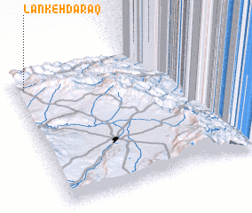 Places with similar names to Lankeh Daraq, Iran ::
// Làng Trac (VN)
// Làng Trươc (VN)
Disclaimer :: Information on this page comes without warranty of any kind |
||
|
Where is Lankeh Daraq? Elevation and coordinates ::
Latitude (lat): 38°55'0"N Longitude (lon): 48°3'0"E
Elevation (approx.): 1744m (map arrows pan, magnifying glasses zoom) |
||
|
Visiting Lankeh Daraq? Hotel/Accommodation ::
Book a hotel in Lankeh Daraq Travel Guide ::
Buy a travel guide for Iran rental cars ::
car rental offers GPS waypoint ::
download a GPX waypoint (PoI) of Lankeh Daraq for your GPS receiver
|
||