|
search place name
|
||
Lāy-e Bīdū (Kermān, Iran)Lāy-e Bīdū is a town in the Kermān region of Iran. An overview map of the region around Lāy-e Bīdū is displayed below.
regional and 3d topo map of Lāy-e Bīdū, Iran ::

Lāy-e Bīdū airports ::
The nearest airport is KER - Kerman, located 155.4 km east of Lāy-e Bīdū.
Other airports nearby include AZD - Yazd Shahid Sadooghi (193.3 km north west), Nearby towns ::
Doqondar (0.6km north) //
Kam‘arūsak-e Bālā (1.8km north) //
Kam‘arūsak-e Pā'īn (2.3km north) //
Moḩammadābād (2.7km west) //
Kamar Mīl (2.9km north west) //
Poshtkūh (3.3km south east) //
Kū Leylā (3.7km north) //
‘Alīābād (3.5km south east) //
Lāy Gūlor (3.6km north west) //
Masīnān (3.7km east) //
Sarchīnū Bālā (3.9km west) //
Bakht Sefīd (4.1km north west) //
Tall-e Sheykh ‘Alī (4.2km west) //
Pāchenār (4.3km west) //
Katjūreh (4.5km south west) //
Darreh Bāgh (5.2km north) //
Rūraz (4.8km west) //
Deh-e Qāzī (4.9km west) //
Kamar Pākash (5.5km south east) //
Zahrū'īyeh (5.2km east) //
Kahn-e Zarān (5.2km east) //
Tall-e Zard (5.2km east) //
Kamar Kamā'ī (5.7km north west) //
Qāsemīyeh (5.5km east) //
Kamar Bāgh-e Salmūn (6.2km south east) //
Pārī Kūh (6.8km south east) //
Jadal Tanān (6.3km east) //
Sabz Mūshān (6.9km south east) //
Sar Qāch (6.5km north west) //
[all distances 'as the bird flies' and approximate] 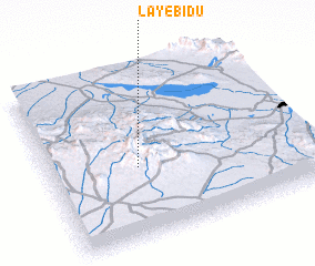 Places with similar names to Lāy-e Bīdū, Iran :: Disclaimer :: Information on this page comes without warranty of any kind |
||
|
Where is Lāy-e Bīdū? Elevation and coordinates ::
Latitude (lat): 30°25'21"N Longitude (lon): 55°20'37"E
Elevation (approx.): 2590m (map arrows pan, magnifying glasses zoom) |
||
|
Visiting Lāy-e Bīdū? Hotel/Accommodation ::
Book a hotel in Lāy-e Bīdū Travel Guide ::
Buy a travel guide for Iran rental cars ::
car rental offers GPS waypoint ::
download a GPX waypoint (PoI) of Lāy-e Bīdū for your GPS receiver
|
||