|
search place name
|
||
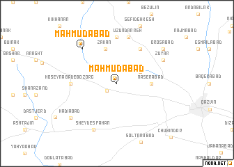
Maḩmūdābād (Iran)Maḩmūdābād is a town in Iran. An overview map of the region around Maḩmūdābād is displayed below.
regional and 3d topo map of Maḩmūdābād, Iran ::
Maḩmūdābād airports ::
The nearest airport is RZR - Ramsar, located 98.3 km north east of Maḩmūdābād.
Other airports nearby include RAS - Rasht (116.4 km north), THR - Teheran Mehrabad Intl (145.7 km south east), Nearby towns ::
Nez̧āmābād (1.8km south west) //
Hemmatābād (3.5km north east) //
Nāşerābād (4.5km east) //
Zākān (5.8km north) //
Nāderābād (6.3km north east) //
Ḩoseynābād-e Bozorg (6.0km west) //
Azūndezeh (7.4km north) //
Ūzūn Darreh (7.6km north) //
Maḩmūdābād (7.1km north west) //
Sheyd Eşfahān (8.0km south) //
Zūyār (7.0km north east) //
Kharman Sūkhteh (8.7km north) //
Hādīābād (8.2km south west) //
Orosābād (8.2km north east) //
Chūbīn Dar (11.1km south east) //
[all distances 'as the bird flies' and approximate] 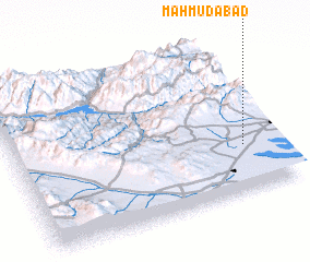 Places with similar names to Maḩmūdābād, Iran ::
// Mǝmmǝdabad (AZ)
// Māmudābād (BD)
// Mahmūdābād (IN)
// Maḩmūdābād (IR)
// Maḩmūdābād (IR)
// Maḩmūdābād (IR)
// Maḩmūdābād (IR)
// Maḩmūdābād (IR)
// Maḩmūdābād (IR)
// Maḩmūdābād (IR)
Disclaimer :: Information on this page comes without warranty of any kind |
||
|
Where is Maḩmūdābād? Elevation and coordinates ::
Latitude (lat): 36°18'0"N Longitude (lon): 49°53'0"E
Elevation (approx.): 1334m (map arrows pan, magnifying glasses zoom) |
||
|
Visiting Maḩmūdābād? Hotel/Accommodation ::
Book a hotel in Maḩmūdābād Travel Guide ::
Buy a travel guide for Iran rental cars ::
car rental offers GPS waypoint ::
download a GPX waypoint (PoI) of Maḩmūdābād for your GPS receiver
|
||