|
search place name
|
||
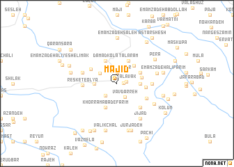
Majīd (Iran)Majīd is a town in Iran. An overview map of the region around Majīd is displayed below.
regional and 3d topo map of Majīd, Iran ::
Majīd airports ::
The nearest airport is THR - Teheran Mehrabad Intl, located 181.2 km west of Majīd.
Nearby towns ::
Pahnedar (0.8km east) //
Talāvak (1.2km east) //
Kolūmak (1.8km north) //
Estakhr Sar (1.8km north) //
Vāv Darreh (2.4km south east) //
Kelīch Kolā (2.4km south west) //
Katrīm (2.8km north west) //
Resket-e Soflá (3.0km west) //
Ja‘far Kolā (3.0km east) //
Par Kūh (3.6km north east) //
Qolqol (3.3km east) //
Dāmād Kola (3.9km north) //
Talāram (3.9km north east) //
Do Mīr Kolā (3.9km north east) //
Moḩammadābād (3.5km north east) //
Khorramābād-e Farīm (4.1km south) //
Kolūmak (3.8km east) //
Margāv-e ‘Olyā (4.1km north west) //
Mateh Kolā (4.5km south east) //
Kheshtestān (4.9km south east) //
Resket-e ‘Olyā (4.5km west) //
Kohneh Deh (4.5km east) //
Margāv-e Soflá (4.8km west) //
Kendelek (4.8km west) //
Shel Darreh (5.4km east) //
Jījād (6.4km south east) //
Khvosh Rūdbār (5.8km south east) //
Perā (6.2km north east) //
Afrāchāl (7.3km north) //
[all distances 'as the bird flies' and approximate] 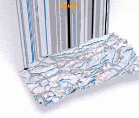 Places with similar names to Majīd, Iran ::
Disclaimer :: Information on this page comes without warranty of any kind |
||
|
Where is Majīd? Elevation and coordinates ::
Latitude (lat): 36°10'3"N Longitude (lon): 53°13'59"E
Elevation (approx.): 788m (map arrows pan, magnifying glasses zoom) |
||
|
Visiting Majīd? Hotel/Accommodation ::
Book a hotel in Majīd Travel Guide ::
Buy a travel guide for Iran rental cars ::
car rental offers GPS waypoint ::
download a GPX waypoint (PoI) of Majīd for your GPS receiver
|
||