|
search place name
|
||
Makān Gaur (Īlām, Iran)Makān Gaur is a town in the Īlām region of Iran. An overview map of the region around Makān Gaur is displayed below.
regional and 3d topo map of Makān Gaur, Iran ::

Makān Gaur airports ::
The nearest airport is KSH - Bakhtaran Shahid Ashrafi Esfahani, located 113.6 km north east of Makān Gaur.
Other airports nearby include SDG - Sanandaj (173.3 km north east), Nearby towns ::
Pelyeh (1.5km west) //
Gāvmīshan (1.5km east) //
Sepāh (1.5km east) //
Sān Neyrī (2.4km north east) //
Gīlāneh (2.4km south east) //
Tambak (3.1km west) //
Sīāhgel (3.6km north east) //
Melyeh Khātūn (4.6km east) //
Ta‘al (5.8km south) //
Tang-e Şandūqeh (7.4km north) //
Darrag (6.4km east) //
Dārvand-e Sartang (6.5km east) //
Cheshmeh Merū (7.2km north west) //
Chehel Zarī (8.2km north east) //
[all distances 'as the bird flies' and approximate] 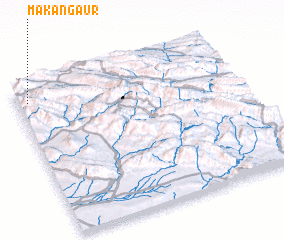 Places with similar names to Makān Gaur, Iran ::
// Mugongora (BI)
// Mkongoro (UG)
// Makangara (NE)
// Maquincara (PE)
// Makangara (NG)
// Makanguéré (ML)
// Mecungura (MZ)
// Makankār (AF)
// Makonkari (SL)
// Makonkuri (SL)
Disclaimer :: Information on this page comes without warranty of any kind |
||
|
Where is Makān Gaur? Elevation and coordinates ::
Latitude (lat): 33°54'0"N Longitude (lon): 46°3'0"E
Elevation (approx.): 853m (map arrows pan, magnifying glasses zoom) |
||
|
Visiting Makān Gaur? Hotel/Accommodation ::
Book a hotel in Makān Gaur Travel Guide ::
Buy a travel guide for Iran rental cars ::
car rental offers GPS waypoint ::
download a GPX waypoint (PoI) of Makān Gaur for your GPS receiver
|
||